The Mountains of Hong Kong — A Hiking Map of Trails, History, and City Memory
Not going up to climb a mountain, but using the mountains to know Hong Kong again
The first time I walked the MacLehose Trail was last November. Got off the minibus at Pak Tam Chung, twenty-three degrees, sea wind blowing in from inner Sai Kung pinning my backpack straps against my ribs. About forty minutes into Stage 1, after the dam at High Island Reservoir, the whole of West Bay (Sai Wan) gradually opened up — the granite jointing cut as clean as a knife, and the distant Po Pin Chau gleaming white in the sun. That was the moment I realized that this city, famous for being crowded, expensive, and vertically dense, is in fact 70% empty land.
That 70% is not a natural number. It’s a political legacy. On August 13, 1976, Governor Murray MacLehose signed the Country Parks Ordinance into effect, and in three years had drawn up 21 country parks covering about 40% of Hong Kong’s land — later raised to nearly 50%, with other protected and undeveloped areas pushing total green-space coverage to 70%. This was avant-garde for 1970s Asia. Tokyo, Taipei, and Seoul were still building housing on their mountainsides; Hong Kong, with one stroke, drew its most valuable 1,500-meter ridgelines into a no-build zone. The fact that today we can climb Lantau Peak at 3 AM for the sunrise, drink a signal-free cold beer at Sai Wan, or step from the center of Hong Kong Island into native forest below Victoria Peak in thirty minutes — all of it is the afterglow of that one signature in 1976.
What’s even more clever is that two governors turned the mountains into personal political totems. MacLehose, during his term (1971–1982), pushed the Ten-Year Housing Programme, set up the ICAC, and steered the early handover talks with Beijing; on his way out, he left a 100-kilometer MacLehose Trail with his name nailed directly to the ridgeline. His successor Edward Youde died in office; the next, David Wilson, was himself a mountaineer and Fellow of the Royal Geographical Society, and four years after his 1992 departure Hong Kong opened the 78-kilometer Wilson Trail. Two of Hong Kong’s four longest trails carry the names of governors — a coincidence almost unique worldwide. Here, mountains are not neutral nature; they’re institutions with people’s names written on them.
The notes below don’t go by geography. They go by three narratives: first, the trails built by colonial governors (the “Four Trails,” four long-distance routes), about how institutions turned mountains into walking paths; second, the mountains as the city’s spiritual symbols (Lion Rock, Victoria Peak, Tai Mo Shan), about how mountains got painted over and over by TV themes, pop songs, and coronation ceremonies into a collective mood; third, the mountains where war and the everyday meet (the Pat Sin Leng fire, the Dragon’s Back sunset, Tsz Shan Monastery) — how the mountains carry the emotions this city has never named aloud. This piece starts with the first.
Image: Wikimedia Commons / CC BY-SA 4.0.
Part I · Trails Built by the Colonial Governors
The “Four Trails” total 298 kilometers, spread across the 17 years from 1979 to 1996. Lay them on a map in opening order and you’ll see one thing: this isn’t trail planning, it’s the physical sediment of institutional history. The MacLehose Trail is the monument to the 1976 ordinance; the Hong Kong Trail is the olive branch the colonial government held out to urban residents in the 1980s; the Lantau Trail marks Lantau’s turn from military zone to tourist island; the Wilson Trail is the last signature drawn on the eve of the 1990s handover. Each one corresponds to a political judgment of its time; today we walk the trail, and what’s paved under our feet is the archive.
MacLehose Trail (1979)
Length: 100 km · Stages: 10 · Opened: October 26, 1979 · Named after: the 25th Governor, Murray MacLehose; Hong Kong’s first long-distance trail.
MacLehose came to Hong Kong in 1971 from a Scottish diplomatic post. When he arrived, the per-capita living space was 3.5 square meters, corruption was rampant, and citizens rarely went up the hills — going up the hills was the business of illegal squatter villages, smugglers, British army firing ranges, and graveyards. In his 11-year term he did three things that rewrote Hong Kong: the Ten-Year Housing Programme (1973, a pledge to house 1.8 million people in public housing in a decade), the founding of the ICAC (1974, in the aftermath of the Peter Godber case), and the 1976 Country Parks Ordinance. The first two are livelihood and rule-of-law; the third looked, to outsiders, almost off-topic — why would a governor facing a population explosion suddenly turn to the hills?
MacLehose’s calculation was very practical. In the early 1970s the New Territories’ rural population was emptying out fast; reservoir catchments were unwatched, and wildfires, illegal logging, and dumping were getting worse. If the hills weren’t given a legal status, by the 1980s urban expansion would eat them. The ordinance was a preemptive enclosure — under the name of country parks, locking the door on 50 years of future development. By real-estate logic this killed a fortune; by urban-planning logic it was a century gamble. Today the gamble looks like it paid off.
On October 26, 1979, the Governor walked the first stage of the trail himself, from Pak Tam Chung to Tai Long Wan. The full 100 kilometers start at Pak Tam Chung in Sai Kung, head west over Ma On Shan, Tate’s Cairn, Lion Rock, Beacon Hill, Tai Mo Shan, Tai Lam Chung, and end at Tuen Mun. A total of 10 stages, each 8–16 km, with distance posts M001–M200, one every 500 m. In 2012, National Geographic included it in its “Best Hikes of a Lifetime” — one of very few in Asia.
Image: Wikimedia Commons / CC BY-SA 3.0.
Image: Wikimedia Commons / CC BY-SA 4.0.
The section that really deserves detail is Stage 2. From Pak Tam Au, you climb over the Chek Keng pass and head south into the Four Bays of Tai Long Wan — Sai Wan, Ham Tin Wan, Tai Wan, Tung Wan — four east-facing crescent beaches strung in a line, with the spiked cone of Sharp Peak behind and the open South China Sea ahead. The whole section is roughly 13.5 km, distance posts M021–M048, and it’s what 90% of Hong Kongers’ deepest impression of “MacLehose Trail” actually means. The white-sand-black-rock contrast is unique here: the bay sand comes from deep-sea quartz weathering and is pure white, while the exposed basalt and granite jointing on the headlands turns ink-black when the tide washes over. From the air it looks like a row of alternating black and white piano keys. As late as 1996, Tai Long Sai Wan was nearly bought by developers for a resort; when the deal was exposed in 2010, the government rushed it into a “designated land” classification and wrote it into the planning framework — that’s the 1976 ordinance still doing its work.
The most iconic micro-slice on Stage 2 is at Ham Tin Wan: dead center of the bay, a bamboo bridge crosses the salt-and-fresh-water meeting at the river mouth, and at low tide a full horseshoe-shaped intertidal flat appears beneath it. Cross barefoot and the sand presses into your soles. At the head of the bridge is Hing Kee Store, in business since the 1980s, run by an auntie surnamed Ho, with cold Tsingtao and Blue Girl always in the fridge behind the counter. It is Hong Kong’s most remote convenience store — two hours of mountain trail to the nearest road.
The other section worth detailing is Stage 4. From Gilwell Camp (founded 1957, the home of the Hong Kong Scout Association) along the Buffalo Hill ridge over Ma On Shan Ngong Ping to Tate’s Cairn, about 12.7 km, distance posts M075–M104. The highlight is Ma On Shan Ngong Ping plateau — about 400 m above sea level, Hong Kong’s largest natural alpine grassland, where a passing kite trails a shadow across the grass. Push north along the ridge and you reach Ma On Shan’s main peak (702 m), with a view that takes in all of Sai Kung Sea and Tolo Harbour. This is also the brutal first leg of the Trailwalker charity race.
Trailwalker is worth a paragraph of its own. In 1981, the Royal Gurkha Rifles stationed in Hong Kong used the MacLehose Trail as their internal jungle-tracking-training course — 100 km, food and water self-carried, 48 hours to finish. Since 1986 the Gurkhas have opened the event to the public, partnering with Oxfam to convert it into a charity fundraiser. Today each November, more than four thousand four-person teams from across Hong Kong start at Pak Tam Chung, aiming to walk all 100 km within 48 hours without sleeping. The fastest record is 11 hours 11 minutes, set by a Salomon trail-running team in 2019. The mountain has, through this, become a kind of collective endurance ritual — once a year, walking from one end of the city to the other.
Logistics: the classic Stage 2 trailhead is Pak Tam Au — MTR Diamond Hill Station Exit B1, transfer to bus 96R (weekends and public holidays only); on weekdays, take bus 92 from Kowloon Tong Station to Sai Kung, then minibus 7 to Pak Tam Au. Ideal departure 8:30–9:30 AM — good light, still cool, and you’ll arrive at Sai Wan in time for lunch at Hing Kee. Supply points: Pak Tam Au (none) → Chek Keng (village houses occasionally sell water) → Sai Wan Hing Kee / Sea Wind Store (lunch + cold beer) → Ham Tin Wan Ho Bak Store (dinner) → Cheung Uk Village (Chek Keng pier is the disembarkation point for Sharp Peak return). The prime photo spot is the southeast ridge of Sharp Peak overlooking all four bays of Tai Long Wan, around M032 — softest light at 3 PM. Hard rules: don’t walk Stage 2 from May to September — typhoon season + rainstorms + 38°C + 100% humidity get people killed on this trail every year. The best season is November through March.
Wilson Trail (1996)
Length: 78 km · Stages: 10 · Opened: January 21, 1996 · Named after: the 27th Governor, David Wilson; Hong Kong’s only trail to traverse both Hong Kong Island and the Kowloon side.
Wilson and MacLehose were two completely different governors. MacLehose was a diplomat-turned-workaholic, fatalist by disposition; Wilson was the quiet China hand — his PhD thesis was on 19th-century British consular practice along the Yangtze, and he spoke both Mandarin and Cantonese. At his 1986 arrival he was only 51, the youngest governor of the time. His term’s biggest headaches were the political shock of 1989 and the new-airport negotiations, but the more interesting story is his personal “other side of the mountain”: a Fellow of the Royal Geographical Society, an amateur mountaineer who had been on a few mid-altitude Himalayan expeditions, and even as Governor still hiked Hong Kong’s trails every weekend. In 1996, four years after his departure, the Friends of the Country Parks proposed naming a trail linking Hong Kong Island and the New Territories after him; Wilson himself flew back, walked the first stage from Stanley Gap Road.
The full 78 km start at Stanley Gap Road on Hong Kong Island’s south end, cross the island ridge to Tai Tam Reservoir above Causeway Bay, cross the harbor to Kowloon Bay, then north over Kowloon Peak, the Ma On Shan west ridge, Pat Sin Leng, ending at Nam Chung (on the Sha Tau Kok bay side). A total of 10 stages, 6–11 km each, distance posts W001–W156. It does something geographically that the MacLehose Trail can’t: a full Hong-Kong-and-Kowloon traverse — from the south coast of Hong Kong Island all the way to the south bank of the Shenzhen River, walking the city’s geographic spine end to end.
Image: Wikimedia Commons / CC BY-SA 2.5.
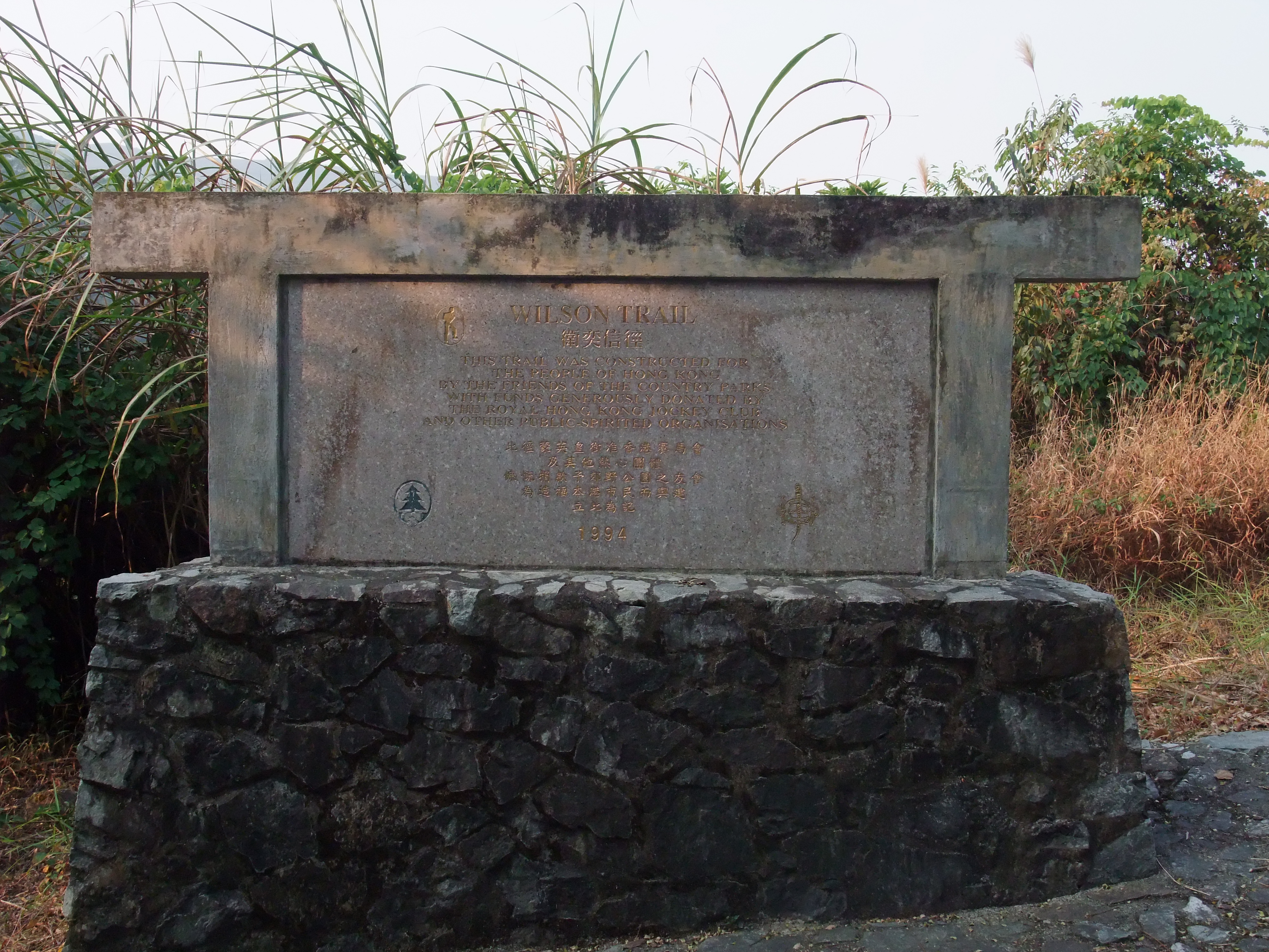
Image: Wikimedia Commons / CC BY-SA 4.0.
The section to focus on is Stage 8. It starts from Kowloon Reservoir, crosses the main ridge of Pat Sin Leng (Immortal Maiden Peak, Xiang Zi Peak, Cai He Peak, Tieguai Peak, Guo Lao Peak, Zhongli Peak, Dongbin Peak, Xiang Zi Peak — eight summits), and is 10.6 km long — the section with the largest elevation gain of the entire trail, with cumulative ascent over 800 m. The Pat Sin Leng ridge is one of Hong Kong’s rare bare-rock cliff terrains; to the south is Plover Cove Reservoir (the world’s first sea-built reservoir, 1968), to the north is Sha Tau Kok bay, with sweeping views. But this section carries a second weight for Hong Kongers: on February 10, 1996, a group of secondary-school teachers and students were caught here by a hill fire that killed 5 people. Two memorial pavilions still stand on the main ridge. The fire, the pavilions, and the collective memory of a generation behind them are saved for Part III. Here I’ll only say: every time I walk past those two red-pillared little pavilions, time pauses for a beat.
Logistics: a through-traverse takes 3–4 days (most people split it across two long weekends). The classic single-day pick is Stage 1 — Stanley Gap Road → Violet Hill → The Twins → Tai Tam Reservoir, about 4.8 km, start in the afternoon, finish by sunset at Tai Tam, and catch bus 14 back to Central. Stage 8 from Kowloon Reservoir requires catching the first bus (bus 72 from Kowloon Tong Station to Kowloon Reservoir Station); the most reliable departure is 6:30 AM. Supply along the trail is sparse — Stages 7 and 8 are nearly waterless — carry at least 2.5 liters. Prime shots: the Violet Hill summit looking down on Stanley Bay (Stage 1); sunset from Shun Yeung Peak (the second highest of Pat Sin Leng, Stage 8). No smoking the entire length — because of the 1996 fire, enforcement on this trail is the strictest of all. During fire season (October–April), violations carry up to HK$250,000 in fines and one year in prison.
Hong Kong Trail (1985)
Length: 50 km · Stages: 8 · Opened: April 1985 · Named after: simply “Hong Kong Island” — the only one of the Four Trails not named for a person.
The Hong Kong Trail’s birth logic is very different from MacLehose’s. 1985 Hong Kong was at its most anxious — the Sino-British Joint Declaration had just turned one year old, the handover countdown had begun, and the uncertainty about the future seeped into everything. The government opened the Hong Kong Trail that year as a gentle gesture: in the tensest months of the Sino-British negotiations, giving the 1 million+ urban residents of Hong Kong Island a doorstep trail, starting at Victoria Peak — 30 minutes of walking from the CBD into native forest — something unmatched in Asian cities.
50 km across the island ridge, 8 stages, distance posts H001–H100. From Victoria Peak the trail heads east through Aberdeen Reservoir, the Tai Tam Reservoir group, Mount Parker, and Tai Tam Gap, ending at Dragon’s Back above Shek O. Each stage is short, 4–8 km — making it the most beginner-friendly of the Four Trails: easy supply, MTR-accessible, in cellular range the whole way.
The section to detail is Stage 2. Start at Victoria Peak, follow the ridge west along the junction of Harlech Road and Lugard Road, and you’ll pass Pinewood Battery. This 1903-built British army battery sits at 307 m — the highest fixed gun position in Hong Kong at the time. Originally fitted with two 6-inch BL coastal-defense guns, anti-aircraft guns were added in 1913, making it one of Hong Kong’s earliest air-defense positions. On the third day of the 1941 Battle of Hong Kong, the battery was destroyed by a single 250 kg bomb dropped by a Japanese aircraft, and the British abandoned it on the spot. Today the trail goes straight through the ruin: ammunition magazines, soldiers’ quarters, gun platforms are all still there, with bomb-cracked walls still visible. The moss-covered concrete disk beside distance post H012 is the original gun base.
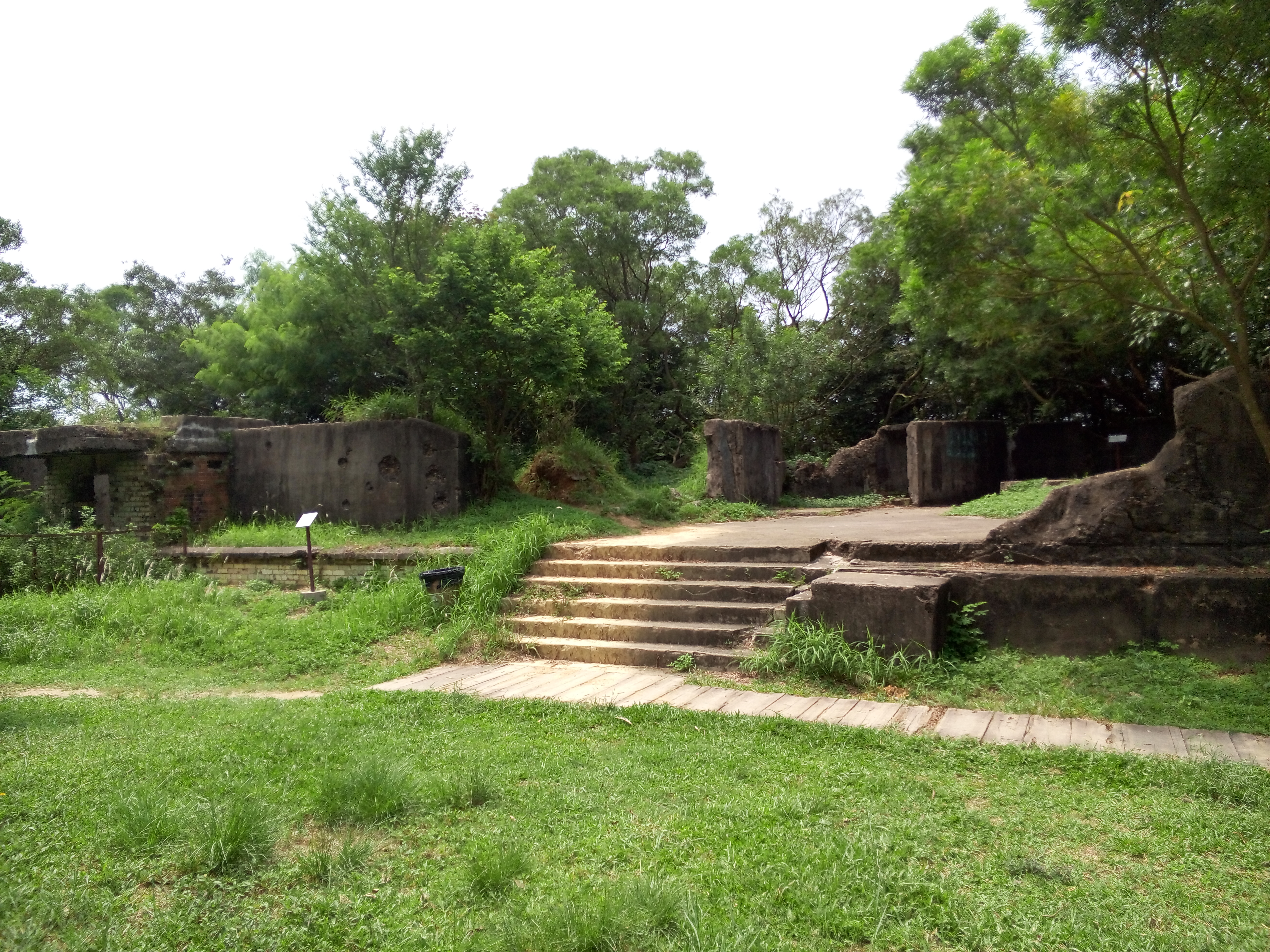
Image: Wikimedia Commons / CC BY-SA 3.0.
Image: Wikimedia Commons / CC BY-SA 4.0.
The Hong Kong Trail has one more place to describe that isn’t strictly on the trail but is right next to it: Wong Nai Chung Gap. Between Stages 3 and 4 — the trail itself swings around Tai Tam Reservoir, but the entrance to the Gap is right at the trail’s edge. On December 19, 1941, the Japanese 230th Regiment landed at North Point and pushed south to cut the Hong Kong garrison’s north-south line. Defending this 800-meter-wide gap was the Winnipeg Grenadiers of Canada — a unit that had been rushed to Hong Kong only in November 1941, average age 22, with almost no mountain-warfare experience. They held the gap for three days and three nights, and the commander, Brigadier John Lawson, was killed on the dawn of December 19 leading a counter-charge from his command post — making him the first British Commonwealth brigadier to die in combat in the entire Second World War. There’s now a Hong Kong Defence Battle Trail at the top of the gap (about 5 km), with 10 stations marking that day’s machine-gun pits, ammunition stores, and field hospital. If you walk the Hong Kong Trail and don’t make the detour into Wong Nai Chung Gap, you’ll have skipped the heaviest kilometer of the whole trail.
Logistics: Stage 2 is the easiest beginner’s section of the Hong Kong Trail — MTR Central Station, bus 15 to The Peak, walk from Lion’s Pavilion along Harlech Road; less than 2 km to Pinewood Battery; paved the whole way, sneakers are fine, 1.5 hours to loop back to The Peak. Stage 8 is Dragon’s Back — but Dragon’s Back’s story and its transformation from an ordinary tail end into “Asia’s Best Urban Hike” (Time Asia, 2004) is saved for Part III. Here I’ll just leave a transition: when you reach the boulder at H094, the sea-sky line opens up and the wind blows in from both sides, and you understand why Time used the phrase “the city’s edge of stone spine.”
Lantau Trail (1984)
Length: 70 km · Stages: 12 (loop) · Opened: December 1984 · Named after: Lantau Peak (934 m), the trail’s highest point; the only one of the Four Trails that’s a loop.
Before the 1980s, Lantau Island was almost another world to Hong Kongers. 50 minutes by fishing boat from Central, no roads to speak of on the island, just monasteries, villages, salt-fish drying yards, and a few abandoned British army camps. In 1983 the Hong Kong government decided to fold all of Lantau into the country park system; the Lantau Trail opened the following year — an unmistakable policy substitution: lock the development out in the name of “country,” hand the island over to hikers and monasteries. The green you see today from Ngong Ping 360 is the green that one signature in 1984 locked in.
70 km around the main Lantau ridge, 12 stages, starting from Mui Wo pier, clockwise through Chi Ma Wan → Cheung Sha → Shui Hau → Shek Pik → Pak Kung Au → Lantau Peak → Ngong Ping → Tung Chung, then around to Tai O → Sham Wat → Yi O → back to Mui Wo. Each stage 2.5–10.5 km, distance posts L001–L140.
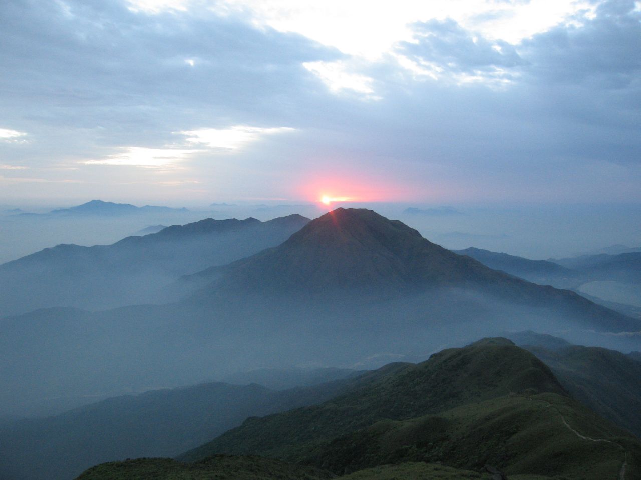
Image: Wikimedia Commons / CC BY-SA 2.0.
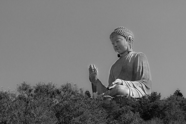
Image: Wikimedia Commons / CC BY-SA 4.0 (Photo: Tore Sætre).
The section to detail is Stage 3 — Nam Shan → Pak Kung Au → Lantau Peak summit → Ngong Ping. This is the most punishing and most iconic leg of the loop, 4.5 km long with 750 m of cumulative ascent. From the pass at Pak Kung Au, it’s almost entirely stone steps upward, climbing to the 934 m summit.
Watching sunrise from Lantau Peak is the most Hong Kong thing about this mountain. Since the 1980s, on every New Year’s Eve, hundreds of Hong Kongers head up after midnight with flashlights and thermoses, summit between 3–4 AM, and wait for the year’s first ray of sun to rise from the open Lantau Sea to the southeast. Lantau Peak is Hong Kong’s second-highest mountain (after Tai Mo Shan’s 957 m), but because it sits at the southwest coast of Lantau, no eastern terrain blocks the view, making it the best summit in Hong Kong for sunrise. Each New Year’s Day around 6:50 AM, hundreds of people on the summit hold their breath as the sky turns from indigo to orange — almost a collective, secular ritual of blessing.
Descend to Ngong Ping and you bump into Po Lin Monastery and Tian Tan Buddha. In 1906, three Chan masters (Da Yue, Yue Ming, Dun Xiu) came to what was then called “Da Mao Peng” (Great Thatched Hut) to practice; in 1924 they formally renamed it Po Lin Monastery, opening one of Hong Kong’s principal Chan monastic lineages. In 1981 the monastery decided to build a bronze Buddha; construction started in 1990, and the consecration was on December 29, 1993. Tian Tan Buddha is 34 m tall and weighs 250 tons, among the tallest outdoor bronze seated Buddhas in the world. The base references Beijing’s Temple of Heaven’s Hall of Prayer for Good Harvests; the Buddha faces north — because in Buddhism “the Buddha sits facing north” gestures compassion toward the believers of the northern direction. From Ngong Ping plaza, 268 steps up reach the foot of the Buddha — these steps aren’t counted in the Lantau Trail mileage; they’re a free, extra ritual.
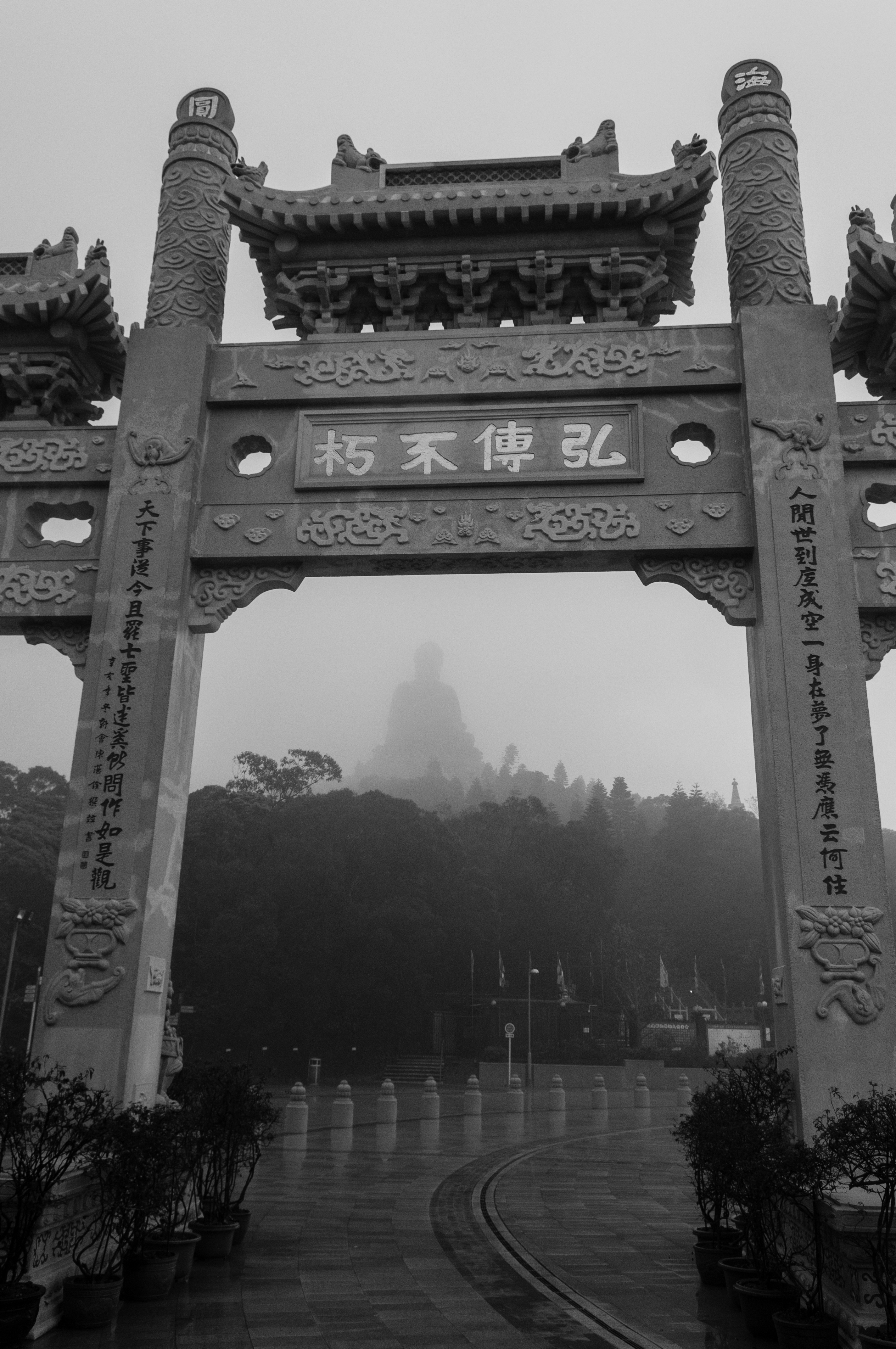
Image: Wikimedia Commons / CC BY 2.0 (Michal Osmenda).
The loop ends near Mui Wo, but before that it passes through Tai O stilt houses. This is an off-trail extension — about 3 hours from Ngong Ping along Lantau Trail Stage 7 to Tai O. Tai O is the last remaining indigenous water-village in Hong Kong, where Tanka people have lived since the early Qing dynasty, peaking at 30,000 residents in the 1950s. Today fewer than 2,000 households remain. The salted-fish drying yards along the shore, the wooden-pile stilt houses on either side of the canal, the ruins of Fu Shan Battery, the Sun Ki Bridge — together they make a 1950s Hong Kong fishing-village specimen. The stilt houses are built on wooden piles driven into the seabed, with floors 2 meters above the tide, connected by wooden planks — the typical living form of Lingnan boat-dwellers since the Qing. In 2000 a fire destroyed half of them; civilian fundraising rebuilt them in 2003. They are now non-tangible cultural heritage listed and protected by Hong Kong’s Antiquities and Monuments Office.
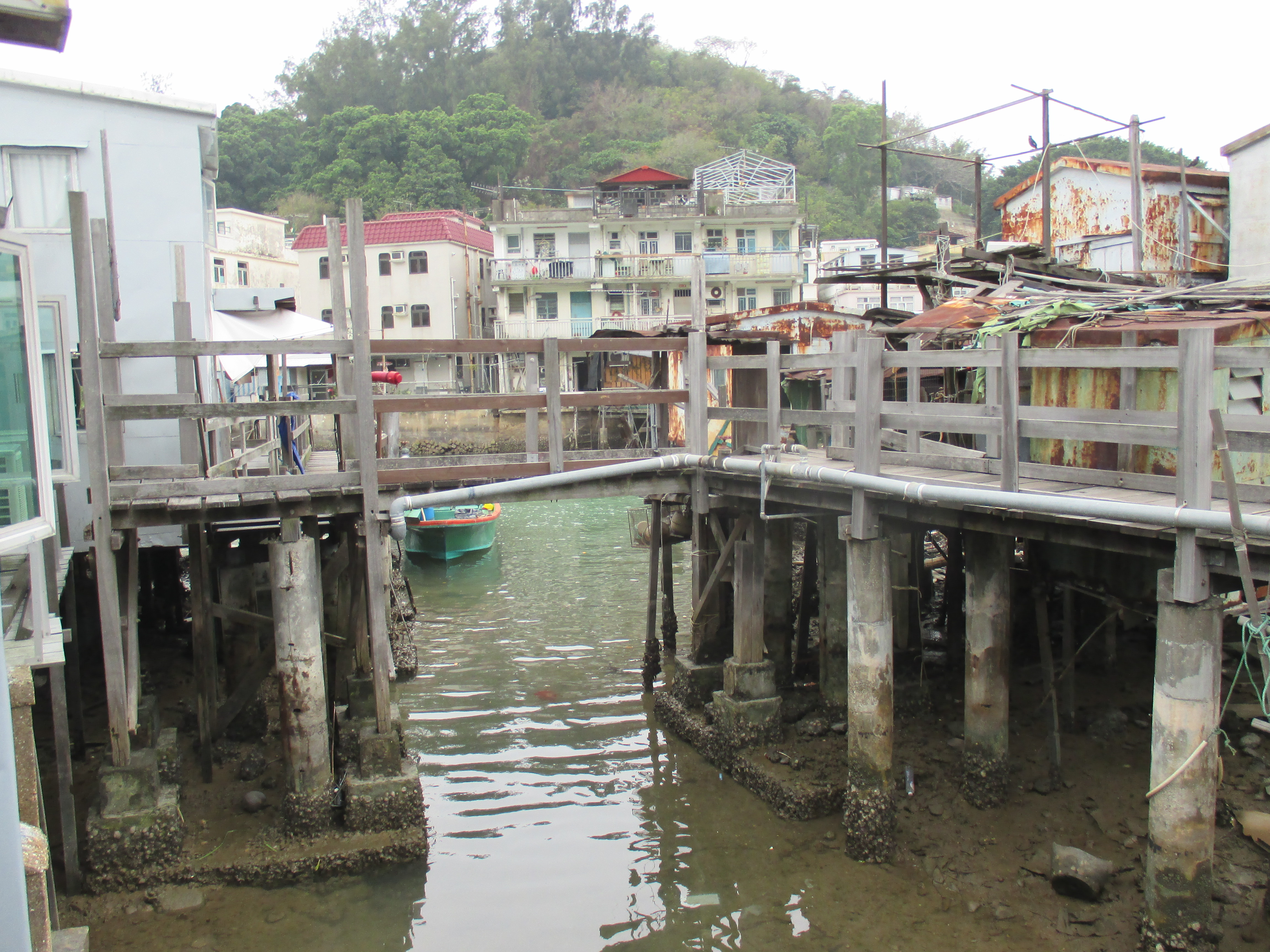
Image: Wikimedia Commons / CC BY-SA 4.0.
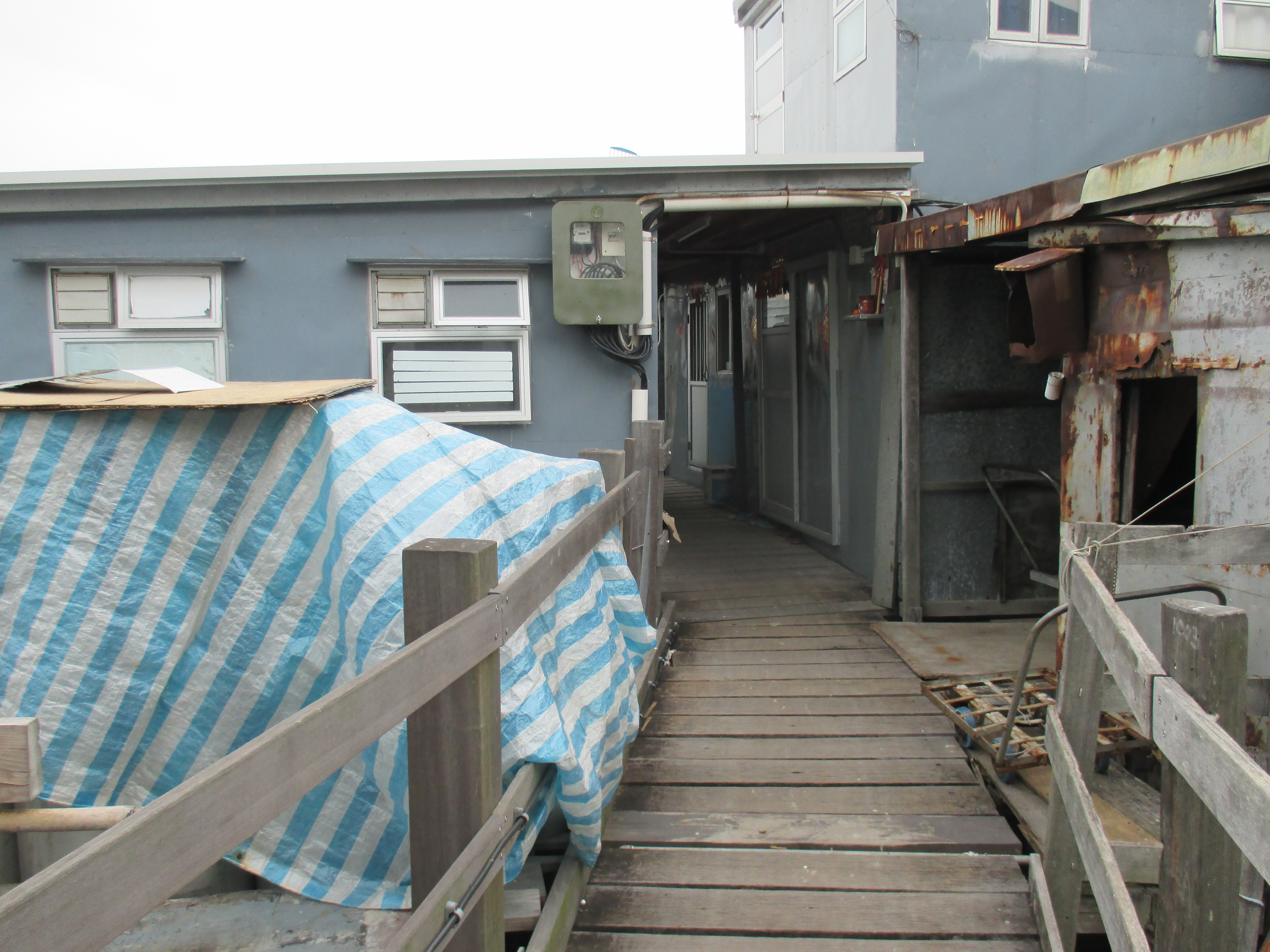
Image: Wikimedia Commons / CC BY-SA 4.0.
Logistics: there are two classic ways to walk Stage 3 (Pak Kung Au → Lantau Peak → Ngong Ping). For sunrise: from Tung Chung MTR Station, take the all-night bus 3M to Pak Kung Au (last departure 2:00 AM), start hiking 3:00 AM, summit 4:30 AM, sunrise 6:50 AM, then descend to Ngong Ping by 7:30 AM to catch the first Ngong Ping 360 cable car back to Tung Chung — this is the classic Hong Kong New Year’s Eve day trip. For daytime: from Tung Chung Station take bus 23 to Pak Kung Au (every 30 minutes during the day), start 9 AM, summit 11:30 AM, reach Po Lin Monastery by 1 PM for a vegetarian lunch (Po Lin Monastery’s vegetarian hall is famous, HK$120 per person including soup and tea, expect a queue), then keep walking to Tai O for the 4 PM ferry back to Tuen Mun or Tung Chung. Supply points: Pak Kung Au (a tea hut with cold drinks and instant noodles) → summit (none) → Ngong Ping (full) → Tai O (full). At the Lantau Peak summit in December, predawn temperatures are 5–8°C, and wind chill can bring it below 0°C — bring a down jacket + wool hat + gloves. The best photo spot is the sunrise rock southeast of the summit (around L032); the secondary is the cable car looking down at the Buddha — not a hike, but a unique angle.
Wilson returned to the UK in 1992; in 1996 the Friends of the Country Parks invited him back for the trail’s opening. As he stepped onto Stanley Gap Road, he said to a reporter beside him: “The best part of being Governor of Hong Kong was the weekends.”
I believe that’s true. The four trails total 298 kilometers, and every kilometer is an extension of that 1976 ordinance — and the existence of that ordinance is, in its own way, a very personal account about mountains that MacLehose and Wilson’s generation of governors left behind, beyond their political ledgers.
In the next chapter, we leave the Four Trails and walk into the stories Hong Kongers wrote into the mountains themselves — Lion Rock, Victoria Peak, and Tai Mo Shan, three local mountains painted over again and again with TV themes, pop songs, and New Year’s fireworks.
Part II · Mountains as Metaphors: Three Cultural Peaks
The trails the governors built are about “putting mountains to use” — as public space, as the line tying the New Territories to Hong Kong Island. But Hong Kong’s mountains are more than that. From the 1970s on, a handful of mountains slowly moved from being geographic markers to symbolic ones: they were written into TV theme songs, brushed into political speeches, printed on Instagram over and over — and hauled off the cliffs by fire-rescue helicopters time and again. The mountains stopped being mountains. They became a catchphrase, a banner that’s hung up and torn down, a casualty log. The three below carry, respectively, Hong Kong’s heaviest, quietest, and most dangerous moods.
Lion Rock (495 m)
Lion Rock isn’t actually that tall. It arches up along the New Kowloon main ridge like a reclining lion — mane to the west, tail to the east, with the bare granite at the head as the “lion’s head” itself, 495 m up. Seen from Hong Kong Island, it’s the familiar skyline along Kowloon’s north; seen from Sha Tin, it puts Kowloon behind it. On one side it presses down on Kowloon Walled City, Wong Tai Sin, and Sham Shui Po — those postwar grassroots neighborhoods; on the other, it presses down on Sha Tin, the new town flattened out of rice terraces in the 1970s. In a sense, the whole “lower body” of Hong Kong has this rock looking at it.
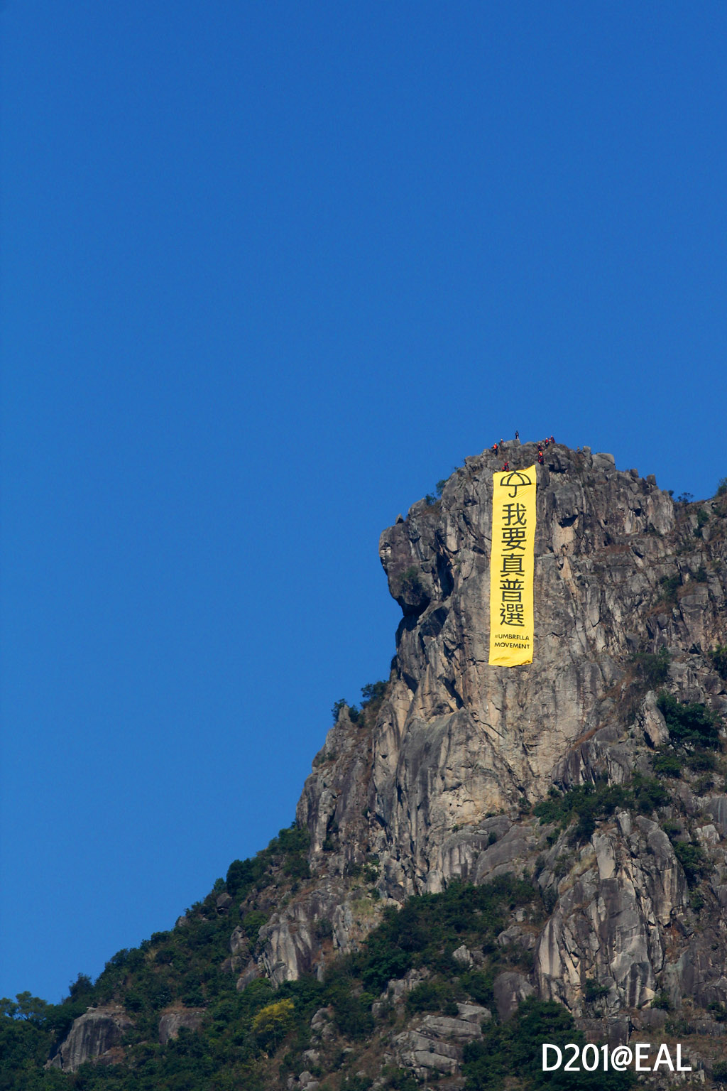
Image: Wikimedia Commons / CC BY-SA 4.0 · Samson Ng.
But what turned Lion Rock from a stone into a spirit is not geography. It’s a song.
In 1972, the TV section of Radio Television Hong Kong (RTHK) launched an anthology drama called Below the Lion Rock. Half-hour standalone episodes, focused on the small lives in Kowloon Walled City, Wong Tai Sin resettlement estates, Sham Shui Po cubicle flats — unemployed dockworkers, widows behind on rent, refugees from Chaozhou. What made the series stand out in its time was that it didn’t teach you how to get rich, only how to endure. In 1979, after seven years on the air, the producers replaced the theme song. Joseph Koo wrote the music, James Wong (Wong Jim) the lyrics, Roman Tam the vocal — and Below the Lion Rock the song was born.
The lines now sound like proverbs: “Life has its joys, but tears come often too” / “At the same corner of the world, hand in hand we walk the rough” / “Together, with toil, we will write the immortal lines of Hong Kong.” Roman Tam’s Cantonese-opera-trained voice gave the song more force than the TV show itself. Through the 1980s — the economic takeoff, the new airport construction, the MTR opening — Hong Kong’s rising middle class found in this song a rationalization of having come up from the grassroots. The “Lion Rock spirit” became this city’s official footnote: diligent, mutual, uncomplaining, climbing.
After 1997, the song kept getting cited. Tung Chee-hwa quoted it in his policy address; CY Leung and Carrie Lam brought it up in public too. The problem is that each time it got quoted, its core wore down a little more. A song originally about working-class struggle was repurposed as a “stay together, stop arguing” tool — same lyrics, completely different context.
Then came October 23, 2014. Day 26 of the Umbrella Movement, with occupations still alive in Admiralty, Causeway Bay, and Mong Kok. That dawn, a group of climbers (later dubbed “Hong Kong Spider-Men” by the media) scaled the lion’s head in the dark and unfurled, on the exposed rock at the cliff edge, a 28-meter-long, 6-meter-wide yellow banner with five large black characters: “I want true universal suffrage.” From Kowloon Tong, Wong Tai Sin, and Kowloon City you could look up and see it. The banner was suspended for hours before firefighters rappelled down and cut it loose — but the photograph had already gone around the world. For the first time, Lion Rock had moved from background to subject.
Image: Wikimedia Commons / CC BY 2.0 · Raita Futo.
In the decade since, whether Below the Lion Rock is still around has become an ambiguous question. It hasn’t been banned; radio stations still play it occasionally; at the old cha chaan teng under tong lau, someone still hums it. But RTHK’s TV anthology of the same name was rescheduled starting 2018; the frequency with which it’s quoted publicly has slid from “every year” to “only on big occasions.” A song that was originally working-class, then co-opted by officialdom, then taken back by citizens, then hung over a cliff — whether it’s on someone’s playlist today has become a statement of where that person stands with this city.
For a pilgrimage, the most-walked route is from MTR Lok Fu Station Exit B, along Wang Tau Hom Road north into Chuk Yuen Estate, then up Sha Tin Pass Road — concrete vehicle road, about an hour at pace. At the Sha Tin Pass pavilion, switch to MacLehose Trail Stage 5 westward — gravel and dirt alternating — about 30–45 minutes to the base of the lion’s head. The “mane” section beyond requires scrambling through a bare-rock crevice — not technical, but very slick after rain; best to come on the afternoon of a day after three rain-free days. The prime photo window is the hour before sunset — shoot from the west Lion Rock summit looking back toward Kowloon. With the sun coming in low from behind you, the Kowloon peninsula transitions from gray-blue to orange-gold, and the silhouette of the rock behind you gets locked in by the last light.
Image: Wikimedia Commons / CC BY-SA 4.0 · Translat99.
I’ve been up twice. The first was spring 2018 — the fog was thick, by the time I reached the lion’s head I couldn’t see down the slope, only wind drawn long through the rock cracks. The second was early winter 2024 — clear skies, and from the top of the mane I could count off all of east Kowloon: the old runway of Kai Tak, the industrial blocks of San Po Kong, the colored facades of Choi Hung Estate. I stood there for twenty minutes saying nothing, then remembered a small thing: in 2002, after Roman Tam sang Below the Lion Rock at a concert, he half-jokingly said, “I’ve sung this song for so many years, I’m sick of it.” He died of liver cancer the next year. No one’s been able to sing the song the way he did since. The mountain is still here; the people who sing it have turned over a generation, and then another.
Tai Mo Shan (957 m)
Tai Mo Shan is the highest point in Hong Kong, 957 m — nearly double Lion Rock, and a clear head above Hong Kong Island’s Victoria Peak (552 m). But its cultural presence is thin. It’s too big, too far, too quiet, and outside the New Territories you can’t even easily see it — hidden behind the new towns of Tsuen Wan, Yuen Long, and Sheung Shui, like a thick quilt at the foot of the bed: no one looks at it specifically, but it’s always there.
The name “Tai Mo” (“Big Hat”) comes from its shape — from certain angles the entire mountain looks like an inverted old-style straw hat, round-topped, wide-brimmed. But the real texture is only visible once you’re inside it: the three subsidiary peaks Grassy Hill, Sze Fong Shan, Tai To Yan reach out southeast, east, and north like three fingers, while the rounded main summit is almost always under cloud — hence the other name “Big Fog Mountain.”
Image: Wikimedia Commons / CC BY-SA 4.0 · Minghong.
The mountain has two easily-missed layers of history.
The first is tea. During the Ming and Qing dynasties, the Tai Mo Shan area was a known tea-producing region in southern China; the local variant of Camellia sinensis grown on the slopes had narrower leaves than the standard Guangdong large-leaf, and produced a clear-bitter aromatic green tea. Locals call it “Fenghuang tea” (note: this varietal name refers specifically to Tai Mo Shan’s local tea, and has no direct relation to either Phoenix Dancong from Chaozhou in Guangdong or Lantau’s Lantau Peak — they share a name but nothing else, a frequent source of confusion). If you walk through the Wo Yang Shan ridge today, look carefully at the ground beneath your feet and you’ll see stretches of stone-laid terraces — moss-covered granite edges, half a meter of drop between platforms — almost weathered into the mountain itself. These are not hiking-trail retaining walls; they are tea-garden terraces. As late as mid-Qing, Hakka people lived in shacks along the slope and harvested the first flush of tea each year before Qingming. After Hong Kong’s founding as a port the tea trade withered, the shacks were abandoned one by one, and the mountain was returned to grass.
The second layer is radar. In 1966 the Hong Kong Observatory built its first Doppler weather radar on top of Tai Mo Shan; the white spherical radome has since become the mountain’s most recognizable landmark — more remembered than any scenic photograph. The radar points at the South China Sea, scans every six minutes, and the data it sends out is the front-line eye of the typhoon-warning system. In 1991 the radome was upgraded; in 2014 it was upgraded again to a dual-polarization S-band system. The white ball on the summit today still looks like a ping-pong ball forgotten on a grass slope, but every day it’s watching the sky for seven million people.
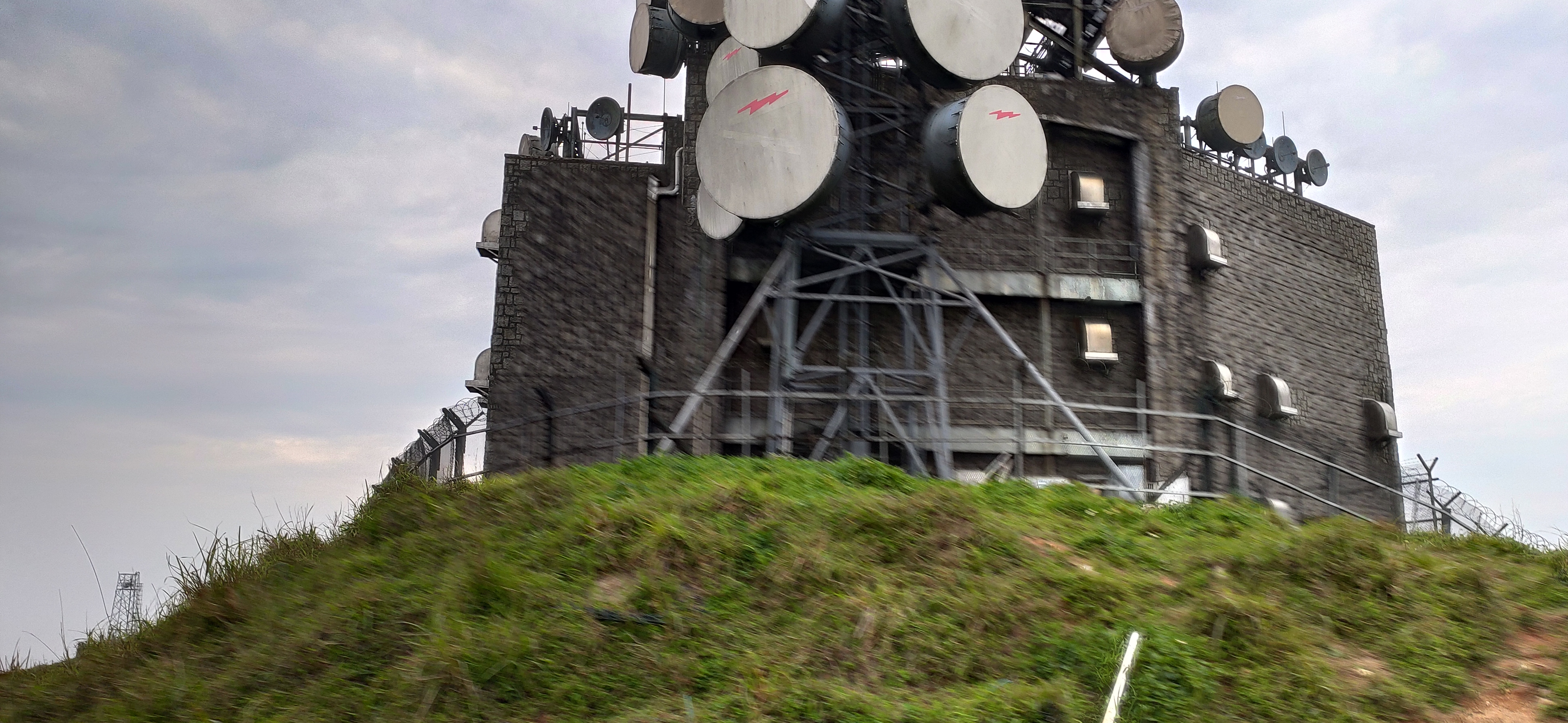
Image: Wikimedia Commons / CC BY-SA 4.0 · Nhk9.
But what’s really put this mountain in the news the last decade is winter.
Hong Kong winters are usually mild — urban-average lows are around 14°C — but every few years, the Siberian high pushes south and the whole Pearl River Delta is soaked in damp cold below 5°C. Tai Mo Shan, with the highest elevation and the most exposed wind, is 6 to 9 degrees colder than the city in these moments. Hoarfrost, rime, and frost flowers were all recorded at the summit in 1975, 1991, 1996, and 2016. The most extreme of them was January 24, 2016 — the so-called “super cold wave.” That day the urban low was 3.1°C (a 60-year record), and the Tai Mo Shan summit recorded −6°C with freezing rain and gale-force 9 winds.
The whole mountain became transparent glass that night. The problem was that the day was a Sunday, and the “frost” news at the summit had been going viral on Facebook, LIHKG, and Instagram all morning — thousands of citizens, with families in tow, rushed up the mountain to see snow they might only see once in a lifetime. By evening, temperatures had plunged, visibility dropped to 5 meters, the trail iced over, and phone signal was blocked by terrain. At least 130 people were stranded on the mountain, dozens with hypothermia symptoms. Fire, police, civil-aid services, and the Government Flying Service ran rescues through the night. No one died, but more than a dozen severe hypothermia cases were hospitalized — and the incident is still a standard case study used in training by the fire service and civil-aid.
For a pilgrimage, plan conservatively. From MTR Tsuen Wan Station Exit W, take bus 51 or Green Minibus 80 to Tsuen Kam Au, the country park entrance. From Tsuen Kam Au, follow Tai Mo Shan Road (a paved road, all uphill) about 4 km, climbing 500 m, 1.5 to 2 hours to reach the radar station. Further along, the MacLehose Trail Stage 8 runs parallel — in summer the grass is chest-high; in winter the entire New Territories plain opens out. For winter trips, check the Hong Kong Observatory forecast first — if there’s a cold-weather warning, drop the plan; don’t get baited by news photos. Dress for the urban temperature minus 6°C, plus a windshell.
I went up in late November 2024 — 18°C in town, 9°C at the summit, fog. Looking north from the radar, the reservoirs of the northern New Territories were ribbons; looking south, all of Kowloon and Hong Kong Island lay under a gray-white blanket, invisible — but audible: a continuous low-frequency hum, like a distant factory still running. I stood on top for about ten minutes and realized for the first time: the highest place in this city isn’t for looking down at it, it’s for listening to it — from up here you can’t see anything specifically, but you can hear seven million people being alive at the same time.
Sharp Peak (468 m)
Sharp Peak is only 468 m, shorter than Lion Rock. But it’s the first of Hong Kong’s “Three Peaks” — the others are High Junk Peak in Sai Kung (344 m) and Castle Peak in Tuen Mun (583 m). “Sharp” isn’t an exaggeration: on a topographic map they all appear as extremely acute triangles, with very narrow ridgelines and final summit slopes routinely above 60 degrees. Sharp Peak is the sharpest, most symmetrical, and most difficult of the three — from certain angles it looks like an isosceles triangle standing on the sea — earning it a nickname endlessly printed in hiking magazines: “the Asian Matterhorn.” It’s an exaggerated comparison, but stand at Chek Keng or Tai Long village and look north once, and you’ll see why.
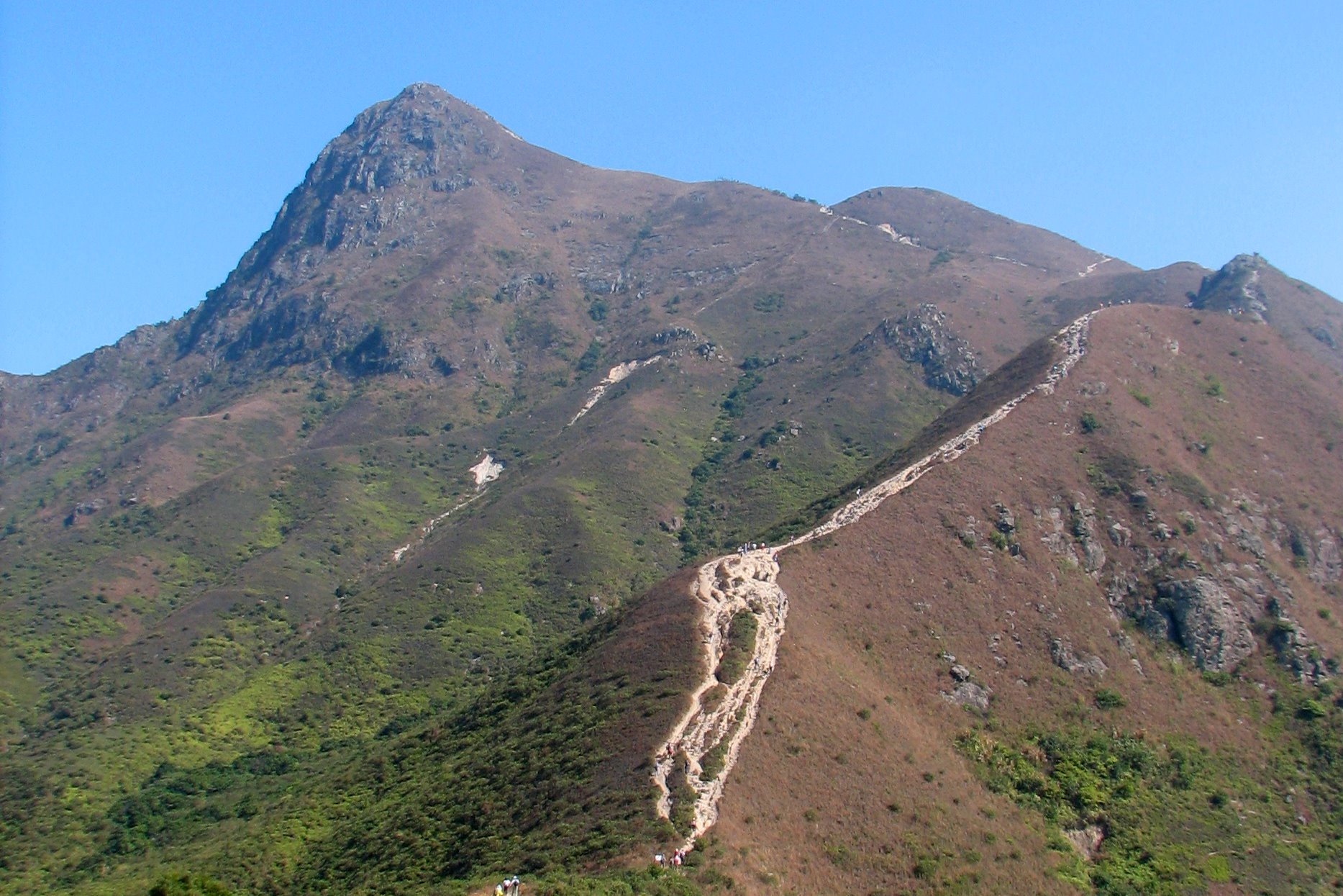
Image: Wikimedia Commons / Public Domain · Chingleung (2008).
Below it lies one of Hong Kong’s most beautiful stretches of coastline — the Four Bays of Tai Long Wan: from south to north, Tung Wan, Tai Wan, Ham Tin Wan, and Sai Wan. White sand, blue water, bays running into bays — CNN ranked them among “Asia’s Most Beautiful Beaches” in 2014. From Sharp Peak summit, looking south, the four bays form a string of pearls, each separated from the next by its own headland. To the west is Cheung Sheung; to the east, open ocean. There are no roads beneath; only the narrow footpath of MacLehose Stage 2 cuts through.
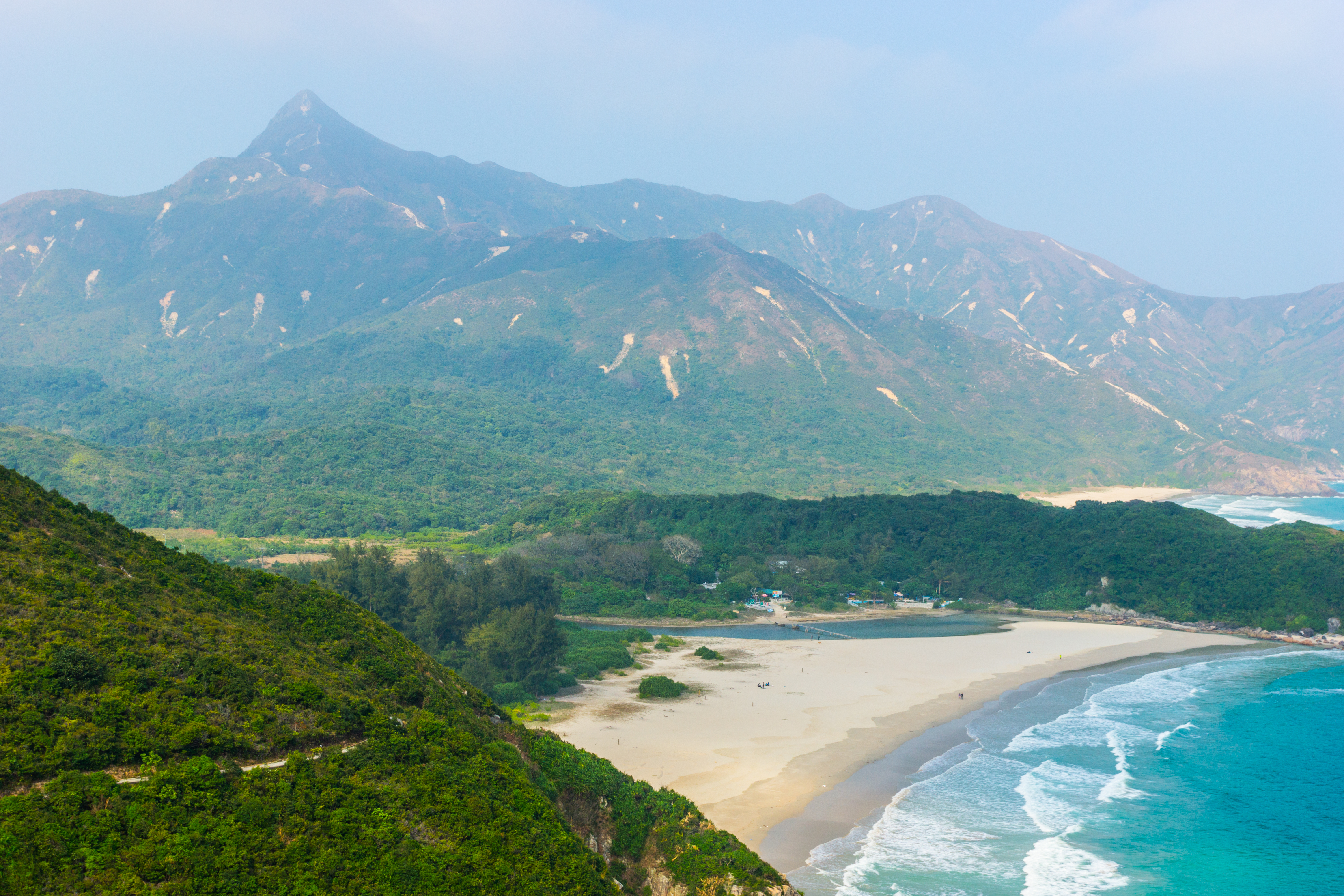
Image: Wikimedia Commons / CC BY-SA 4.0 · Quince Pan.
Human history here goes back further than you’d think. The saddle between Sharp Peak and Chek Keng, in the 19th century, was a Hakka settlement zone — the villages Chek Keng, Tai Long, Tung Wan, Ham Tin all have remnants of Hakka ancestral halls. Villagers fished, made salt, and grew sweet potatoes for generations, connected by stone-paved paths. From the 1950s, young people drifted down to factories, restaurants, and docks in Kowloon; from the 1960s the elderly followed. Go to Chek Keng today and you’ll find mostly collapsed village houses — half-walls of stone, fallen roof ridges, doorframes upended by banyan roots. The Holy Family Chapel, left by Catholic missionaries a century ago, still stands relatively intact by the bay. It’s a rare Hakka village–Catholic mission palimpsest in Hong Kong.
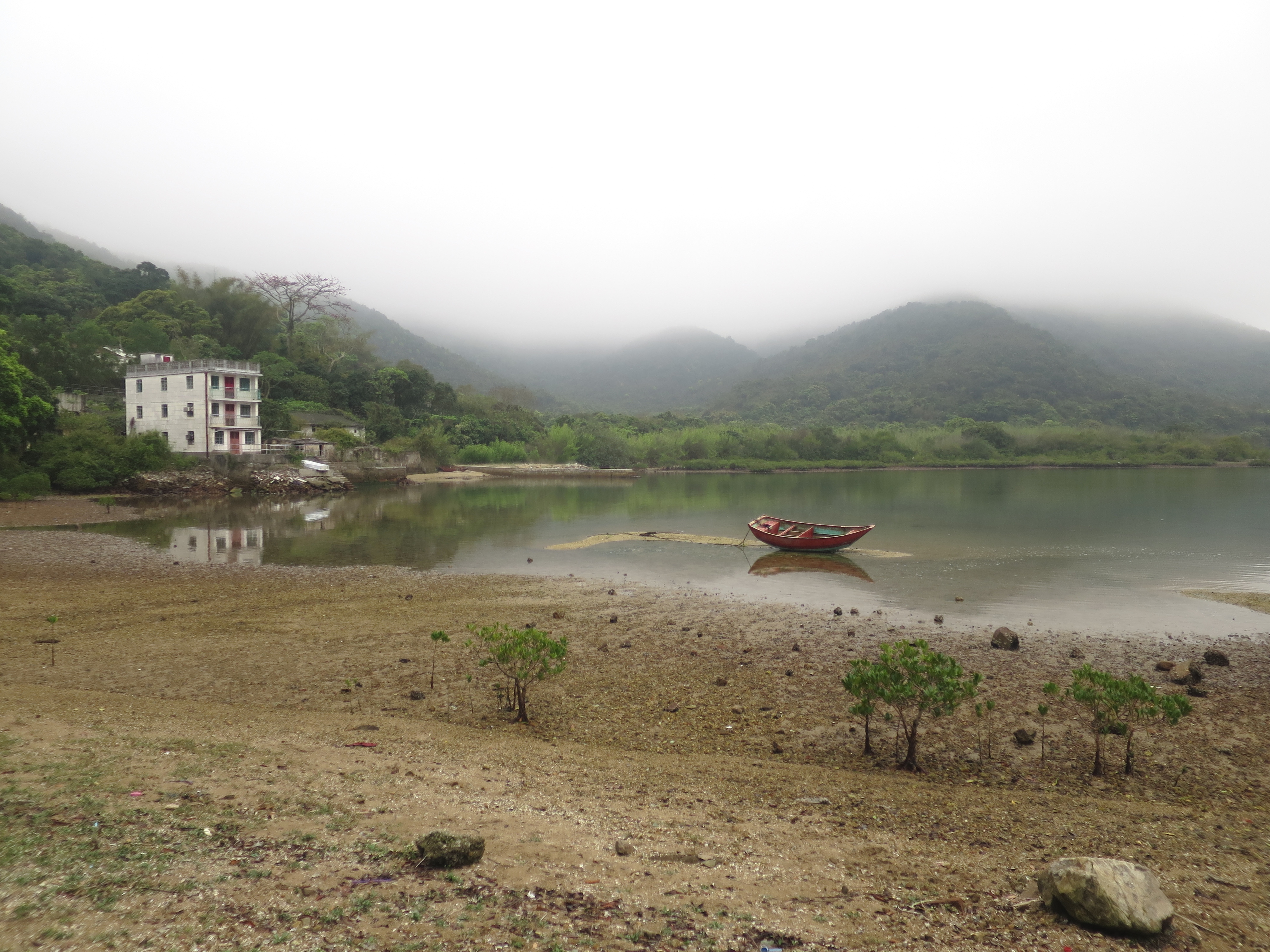
Image: Wikimedia Commons / CC BY-SA 3.0 · User:Geographer (2014).
A hundred years earlier, this area was used by a very different kind of person. Cheung Po Tsai (1786–1822) — the most famous pirate of southeastern Guangdong during the Jiaqing reign, supposedly commanding 600 ships and tens of thousands of men at his peak — used Sai Kung’s many inner bays as his shelter coves. Around Tai Long and Chek Keng, the legend of “Cheung Po Tsai’s treasure cave” still circulates; Cheung Chau and Lamma each have their versions. Most of it is unprovable, but one thing is clear: before the 19th century, Hong Kong’s mountain-and-sea interface wasn’t “nature” — it was a gray zone layered out of smuggling, piracy, Hakka villages, and fishing seasons. Sharp Peak’s razor of a ridge was a lookout for spotting movement on the water — not an Instagram spot.
It became an Instagram spot only in the last ten years. Around 2014 the mountain’s silhouette began circulating in Hong Kong photo communities — especially the view from Sharp Peak Saddle, foreground Cheung Sheung grassland, midground the bays, background the pyramid summit. Every autumn-winter weekend, hundreds of people queue up there for photos. The problem is that this mountain’s danger is badly underestimated.
The final summit pitch on Sharp Peak isn’t a hiking trail, it’s a scramble. Slope 60–70 degrees, with finely weathered schist mixed with small pebbles — like climbing stairs on ball bearings. Going up is easier than coming down. On the descent, the slightest shift in center of gravity sends gravel sliding with you. The summit is also a clear wind funnel — in winter, northeasterly monsoon gusts of force 8–10 can blow you off the side. Between 2018 and 2024, Sharp Peak has had at least 8–10 incidents requiring fire-service helicopter winch rescues — slip-and-fall fractures, post-rain mud slips, hypothermia, lost at night. There were fatal accidents in 2019 and 2022.
For a pilgrimage, set aside a full day and assess weather and fitness honestly. From MTR Diamond Hill Station Exit C2, walk across to the Diamond Hill bus terminus and take the green minibus 96R (weekends and public holidays only; weekdays, take bus 92 to Sai Kung town, then 94 or a taxi to Pak Tam Chung) to Pak Tam Chung. From Pak Tam Chung along MacLehose Stage 2 — the first segment is paved fire road; after Long Ke it becomes dirt — about 4 hours to Sharp Peak Saddle (where the MacLehose leaves the main line and meets the summit spur). From the saddle to summit is about 1 hour (the last 30 minutes are the gravel pitch). Descend north along a steeper ridge to Tung Wan, about 1.5 hours. With photos and breaks, the whole route is 8–9 hours minimum; strongly recommend starting before 7 AM and clearing the gravel pitch before 4 PM. Don’t attempt within 48 hours of rain. Don’t go solo.
I’ve reached its foot twice — and both times I didn’t go up. The first was autumn 2022; by the time I reached Sharp Peak Saddle it was already 2 PM, the gravel slope was clearly still wet from the previous night’s rain, and several hikers coming down were scooting along the same line on their backsides. I took one look and turned back via the Tai Long village line to Chek Keng. The second was early spring 2024 — perfect weather, plenty of energy — but at the saddle the wind rolled in from the north and blew my hat off three times, and I turned back again. On the way down I remembered a line: mountains are beautiful, and beautiful mountains demand a price. Sharp Peak looks on the map like a tiny 468 m peak, but every year it takes something from the hikers’ hands — sometimes a finger, sometimes a rib, sometimes a life. It isn’t the Matterhorn. It’s itself.
Part III · Short Routes at the City’s Edge
After the New Territories’ ridges and hill fires, pull the gaze back. Most Hong Kongers’ real memory of the mountains isn’t at MacLehose distance post 24, or in the fog of Lantau — it’s of the kind of mountain you can see fifteen minutes after leaving the MTR. Mountains in this city were never far away; they’re the direction you walk in your trainers at 9 AM on Saturday. This section is about three routes pressed closest to the city: Dragon’s Back, Devil’s Peak to Kowloon Peak, and Pat Sin Leng. Each one heavier than the last. The first is the entry; the second is history; the third is unavoidable tragedy.
Dragon’s Back — The First Mountain for Beginners
If you’re allowed only one trail to recommend to a first-time visitor, every Hong Konger will recommend the same one: Hong Kong Trail Stage 8, Dragon’s Back. About 8.5 km, high point Shek O Peak at 284 m, from stepping off the bus to changing clothes on the beach and catching the bus back to town, the whole flow is exactly half a day. It’s not the island’s most spectacular mountain, but it’s the most perfectly-pitched introduction — easy supply, clear bailout routes, scenic density well beyond what a city trail should have.
The marketing line that made it famous came from 2004: that year Time Asia picked Dragon’s Back as the “Best Urban Hike in Asia,” and every government tourist brochure and Lonely Planet has been quoting it ever since. The absurd part is that Time Asia discontinued its Asian print edition in 2009, and few people today remember what the magazine looked like — but the tag it nailed onto Dragon’s Back has outlived it. This sort of thing isn’t rare in Hong Kong: names, organizations, claims left over from the colonial period — the original is long gone, but the name keeps drifting around on the city’s hills and streets.
What really makes Dragon’s Back beautiful is it actually looks like a dragon’s back. From Shek O Peak heading toward Shek O, on the left is Tai Tam Reservoir and the Cape D’Aguilar peninsula reaching into the South China Sea; on the right are the red roofs of Shek O village and the reef off D’Aguilar. The ridge itself isn’t wide; the surface is red earth and gravel beaten flat by hundreds of thousands of shoes, and every stretch or two exposes a vertebra of granite. On winter mornings, when the sun comes in at an angle, the whole spine takes on a pale yellow tone — local photographers say Dragon’s Back only exists from November to February; the rest of the year it’s a different mountain inside the fog.
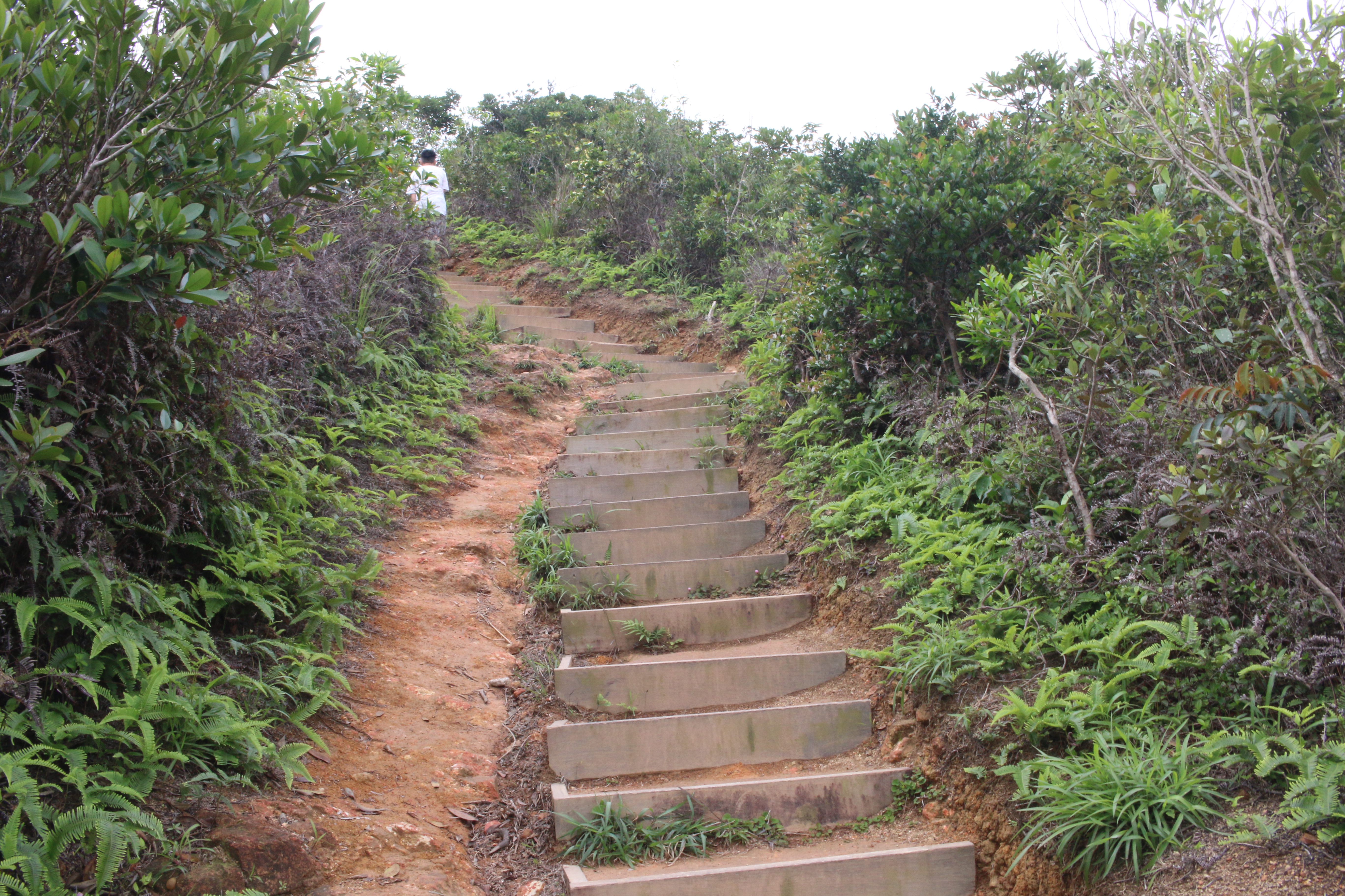
Image: Wikimedia Commons / CC BY-SA 4.0.
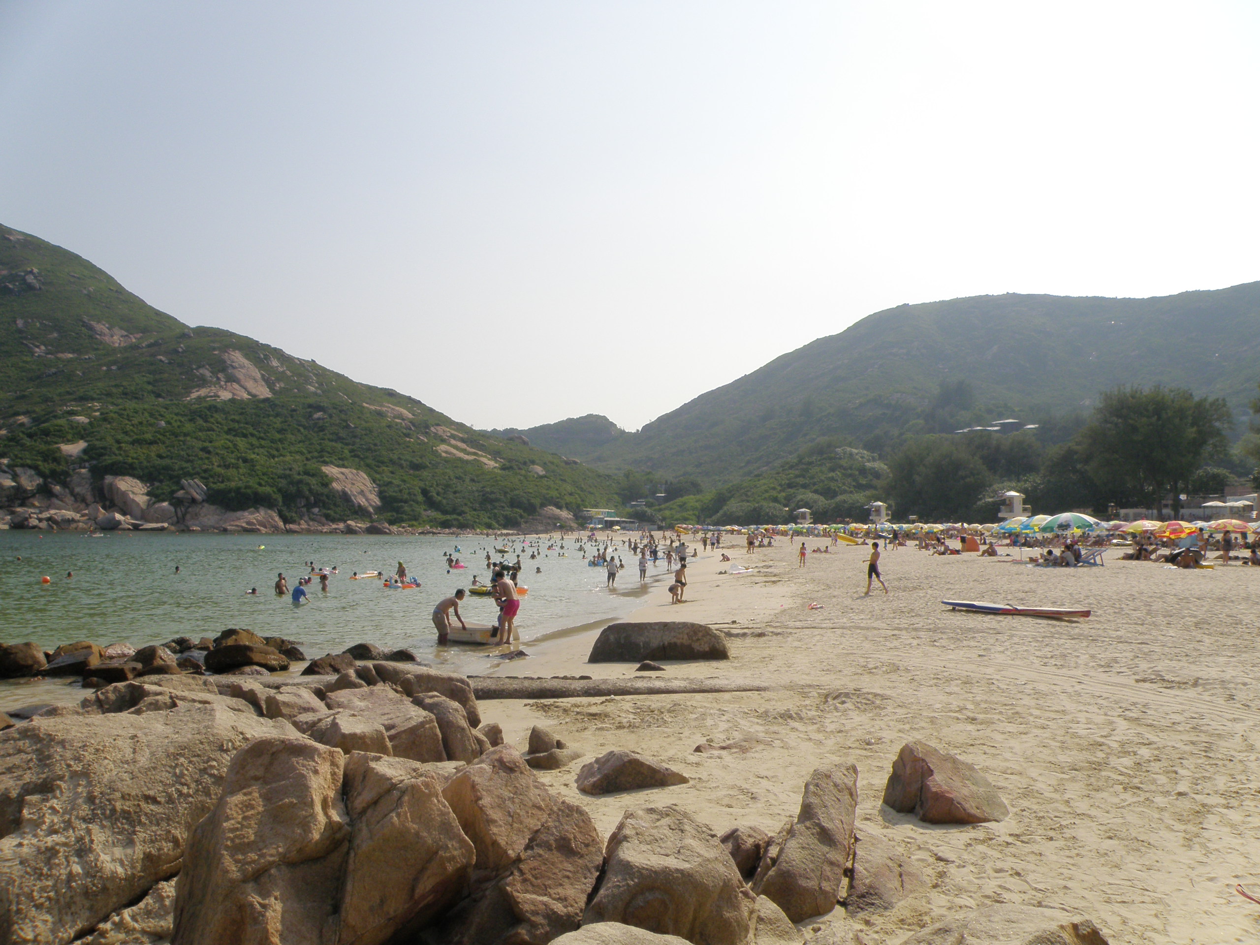
Image: Wikimedia Commons / CC BY-SA 4.0.
Here’s the smoothest version of the walk. MTR Chai Wan Station Exit A to the bus stop across the road, catch bus 9 toward Shek O terminus, about 25 minutes to “To Tei Wan” stop — when boarding, the driver may ask “Dragon’s Back or Shek O?” — answer “Dragon’s Back,” and he’ll ring the bell for you. The trailhead is right across the road, marked “Hong Kong Trail Stage 8.” About 40 minutes up to Shek O Peak, then an hour-plus along the ridge down to Big Wave Bay — one of the few beaches on Hong Kong Island with a real surf culture, with board-rental shacks, pineapple-ice and beer carts, and showers. Rinse off, dress, take bus 9 back to Chai Wan; the whole circuit is 3 to 4 hours. Best time: autumn-winter mornings 9–11 AM — later there’s no shade on the ridge; earlier the buses haven’t ramped up.
Why does everyone advise first-timers to come here? Because it demonstrates “the standard answer to Hong Kong’s mountains”: reachable by MTR + bus, a ridge with 15-degree undulations, scenery that changes every 30 seconds, a beach + shower + cold beer at the finish, one bus back to town. It requires no preparation — sneakers, a bottle of water, a hat — and three hours later you can post “I’ve hiked Hong Kong too” on Instagram, and you’ll most likely fall in love with this from there. Its real function isn’t to let you complete one hike — it’s to leave you thinking “next week I can do a harder one.” This city trains hikers by giving you Dragon’s Back as a sugar shot first.
Devil’s Peak + Kowloon Peak — War Remains and “Suicide Cliff”
Step out of Yau Tong MTR Station Exit A2 and look up — you’ll see a green, not-very-tall mountain — Devil’s Peak, 222 m. The name is the first layer of the mountain’s history. In the mid-to-late 19th century, pirates frequented the waters at the eastern end of Victoria Harbour; the Lei Yue Mun Channel at its narrowest is only about 500 m wide — the throat into the inner harbor from the open sea — and the British and local fishermen alike called it “Devil’s Peak,” the place where devils lived. After the 1898 New Territories Extension Convention, the whole east Kowloon coast came under British rule, and Royal Engineers began converting Devil’s Peak into the eastern keystone of Victoria Harbour’s defenses.
Three things remain. Gough Battery on the south side was built between 1898 and the early 1900s, originally with two 6-inch breech-loaders. Pottinger Battery on the north slope, built around the same time, also 6-inch. Devil’s Peak Redoubt in the center is a complete polygonal redoubt with about 1 m of concrete; today you can still see cement plaques stamped with years like “1914,” preserved magazine vaults, machine-gun loopholes, and a tunnel running south-to-north through the interior. The two batteries and redoubt are connected by a trench, “Trench to Devil’s Peak Fort” on the maps; together they are now a Grade II historic site under the Antiquities and Monuments Office.
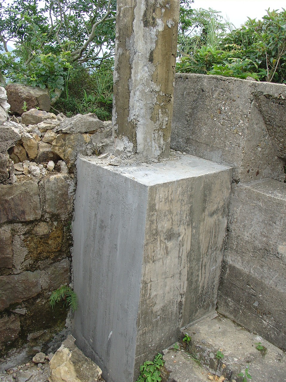
Image: Wikimedia Commons / CC BY-SA 4.0.
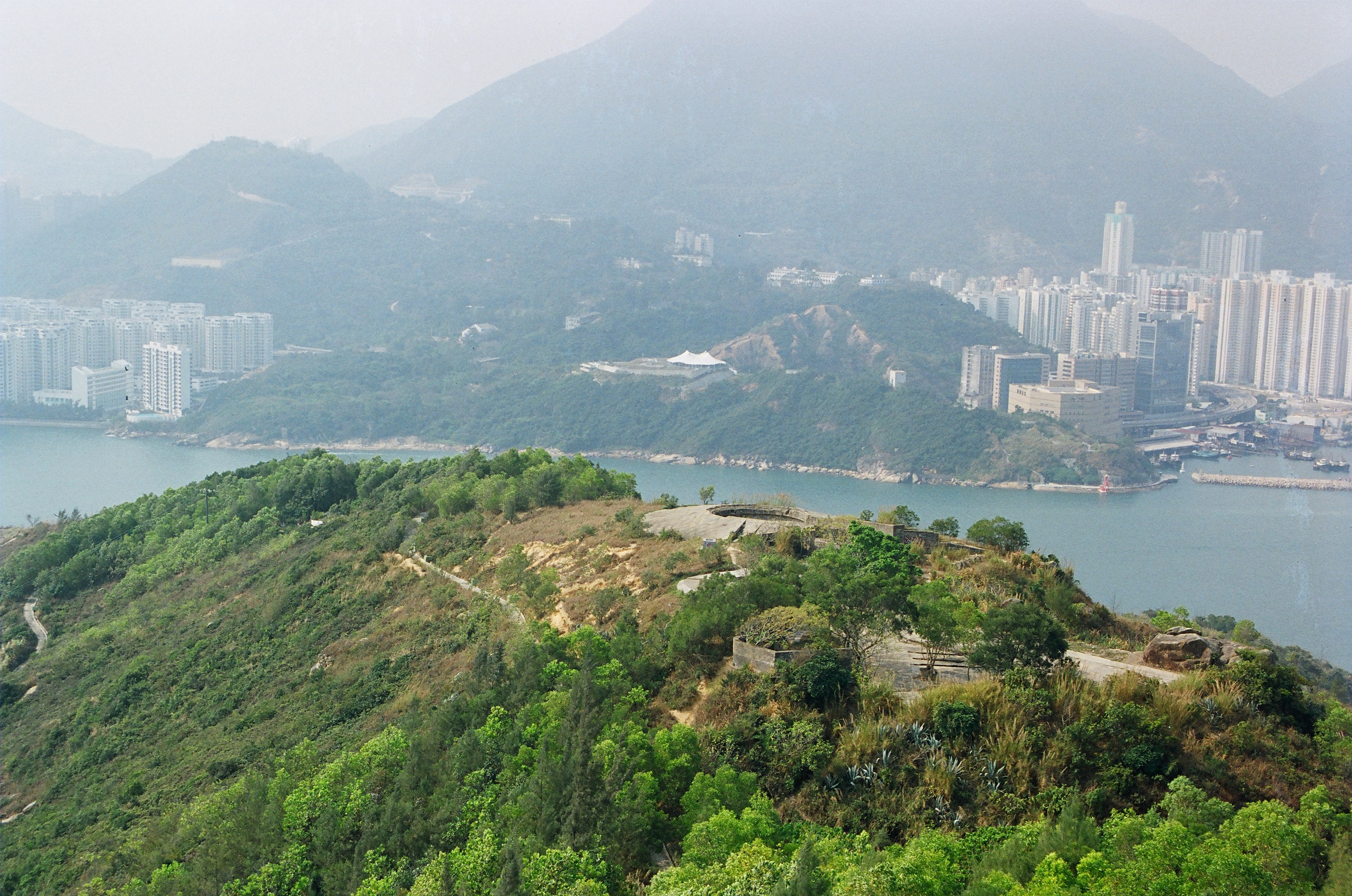
Image: Wikimedia Commons / CC BY-SA 4.0.
What put Devil’s Peak in the history books was December 1941. The same hour the Japanese hit Pearl Harbor on December 8 (Hong Kong time), they crossed the Shenzhen River and attacked Hong Kong. From December 8 to 13 they pushed across the New Territories and northern Kowloon. On December 11, the British decided to retreat from Kowloon to Hong Kong Island — and Devil’s Peak was the last meaningful firing line in Kowloon. A battalion of the Royal Scots and Rajput soldiers of the 2/14 Punjab Regiment held the Devil’s Peak line against the Japanese 230th Regiment until the last ferry that night carried the rearguard and wounded across Lei Yue Mun to Shau Kei Wan on Hong Kong Island. Only then did Kowloon officially fall. The island surrendered on December 25 — Hong Kong’s “Black Christmas.” Today, on the concrete arches of Gough Battery, you can still see the impact scars of the shelling, rusted bolts embedded in the cement of the machine-gun pits — lower your head once, look up at the harbor, and suddenly you realize that the neon-lit Central across the water was once aimed at through that loophole.
North of Devil’s Peak is Kowloon Peak (602 m) — also called Kowloon Peak (Fei Ngo Shan), the highest point of the screen-wall range behind the Kowloon Peninsula; from Tsim Sha Tsui looking north, the ridge that lies across the sky is this. What Kowloon Peak is really famous for isn’t the summit but the rock platform jutting out from its northeastern face into nothing — “Suicide Cliff.” It’s a horizontally projecting thin slab with almost no support; standing on it and turning back, you see all of Kowloon Bay, Kai Tak, Choi Hung, San Po Kong out to Victoria Harbour and the north shore of Hong Kong Island laid out at your feet. Around 2015 the platform began going viral on Instagram, becoming a fixture under the Hong Kong hashtag #suicidecliff. To clarify: the word “Suicide” comes from the geography — the platform overhangs, a single misstep is a hundred-meter drop — not from any specific incident, though in recent years there have been numerous photo-shoot injuries, and the entrance off Fei Ngo Shan Road now bears bilingual government warning signs.
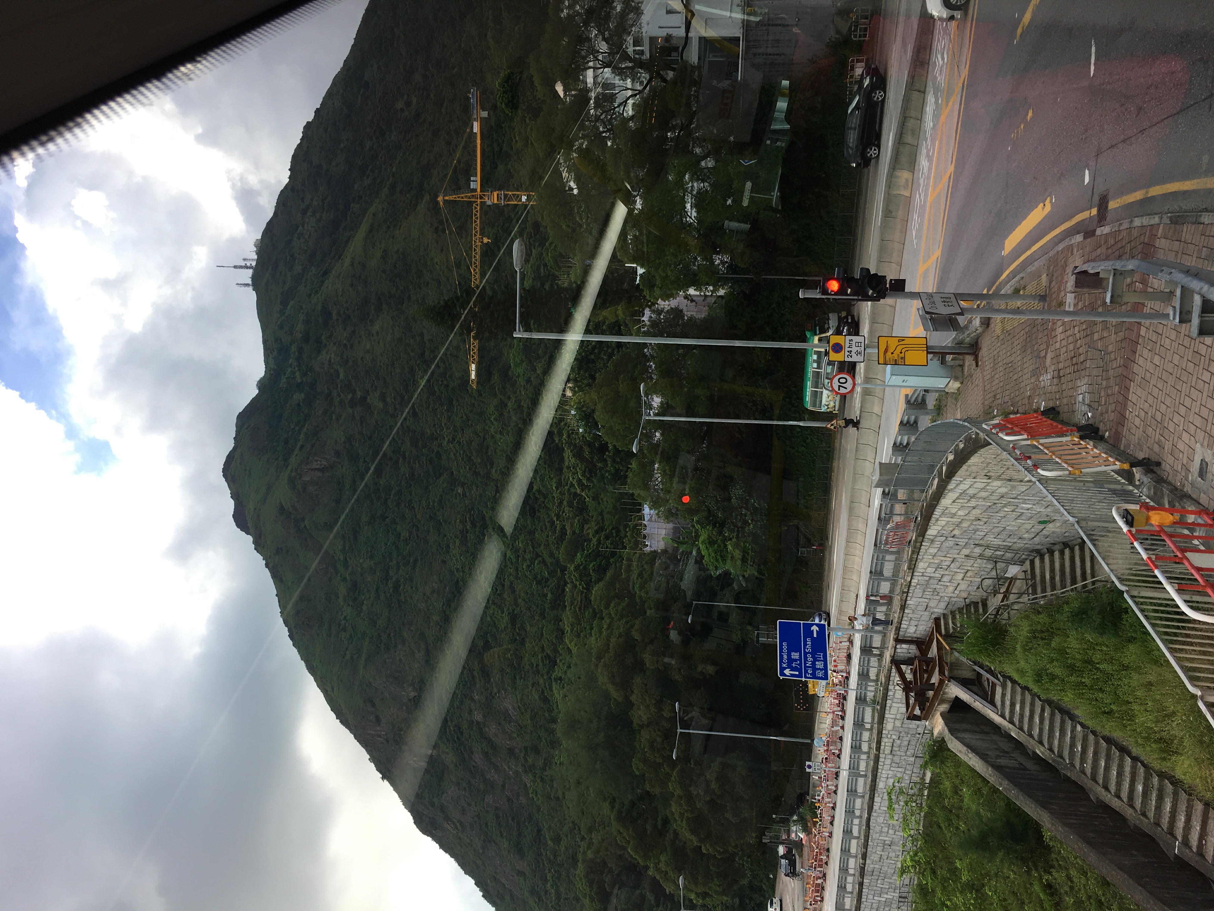
Image: Wikimedia Commons / CC BY-SA 4.0.
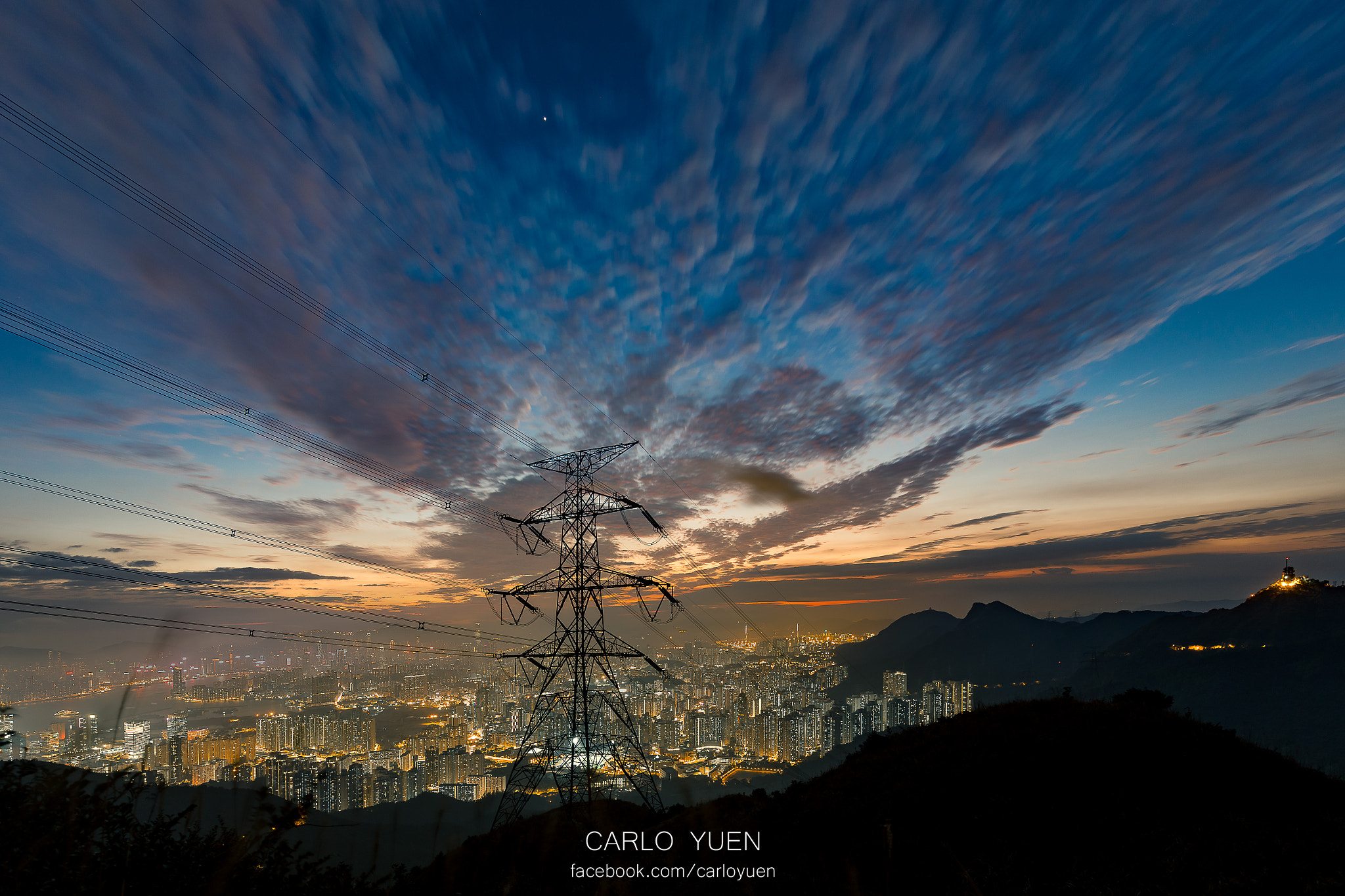
Image: Wikimedia Commons / CC BY-SA 4.0.
You can do both mountains in a single push, but the route matters. The classic version is Devil’s Peak north to Kowloon Peak: from Yau Tong MTR Exit A2, 10 minutes on foot to the Devil’s Peak entrance, loop counterclockwise from Pottinger Battery through the battery, redoubt, and Gough Battery — about 1.5 hours back down to the base; then north along Wilson Trail Stage 3, joining Fei Ngo Shan Road (an asphalt mountain road, walkable or rideable) all the way to the Kowloon Peak summit parking lot, then a trail spur down to Suicide Cliff. Total 5 to 6 hours. If you only want Kowloon Peak, the simpler entrance is Pak Fa Lam — the burial site of Sun Yat-sen’s mother, Madame Yeung, interred in 1910, today a Grade I historic site of Hong Kong; the headstone in granite reads “Tomb of Madame Sun of Heung Yi.” From MTR Diamond Hill or Choi Hung Station by minibus or on foot, about 30 minutes to Pak Fa Lam, about 2 hours to summit.
I prefer the route from Devil’s Peak. Sitting under the concrete arch of Gough Battery to drink water, the whole eastern end of Victoria Harbour opens up in front of you: on the left the narrow Lei Yue Mun channel, the residential blocks of Yau Tong and Tseung Kwan O; on the right the Shau Kei Wan-to-Quarry Bay skyline of Hong Kong Island; in the middle the never-stopping Star Ferries and massive container ships. The last British evacuation boat on December 12, 1941 crossed this water. Concrete cool against your back, a working modern port ahead of you — the layer between history and the present is just a skin. This is the biggest shock Hong Kong’s mountains give you: unlike many mainland mountains that pull you into a place unrelated to daily life, here you sit on an 1898 gun position and watch a 2026 ferry cross the harbor.
Pat Sin Leng — The Spring Wind Pavilion That Won’t Burn
Northeast New Territories, above Tai Po and above Plover Cove Reservoir, eight peaks join up. Immortal Maiden, Xiang Zi, Cai He, Cao Jiu, Tieguai, Guo Lao, Zhongli, Chunyang — laid out west to east, one peak for each of the eight Daoist Immortals. Climbing all eight in sequence is called “Crossing the Eight Immortals.” The highest, Chunyang Peak, is 591 m; Wilson Trail Stage 8 runs the entire ridge from west to east — one of the most expansive ridge traverses in the New Territories: south overlooks Tai Po town and Tolo Harbour, north looks at the surface of Plover Cove Reservoir and, further north, Shenzhen’s high-rises.
But most people who come to Pat Sin Leng know this mountain for another reason.
February 10, 1996, Saturday, around 1 PM. About a hundred people — scouts from the Kowloon-Hong Kong Boy Scouts Association Whampoa District and teachers and students from Pak Kau College — were on their annual hiking exercise, climbing up from Yi O village. The day was dry; around 1 PM dry grass at Yi O caught fire, and the hill blaze rode the northeast wind up the slope, catching the group just as they were climbing Immortal Maiden Peak. Five students — Lai Chi-wang, Liu Chun-kit, Chan Ho-yin, Ho Ho-cheong, Chau Man-fai (per the memorial registry later published by the Hong Kong Education Bureau, ages 13 to 17) — and two teachers, Wong Sau-mei and Chow Chi-chai, died in the flames; many others were severely burned. It remains the single deadliest day on Hong Kong’s mountains.
Note: the names above use the standard transliterations as they appear on the commemorative registry. For the official record, please refer to the Spring Wind Pavilion inscription at Pak Kau College and the Hong Kong Education Bureau’s public archives.
After the fire, Hong Kong’s primary-and-secondary outdoor-education system, the Fire Services Department’s hill-fire warning system (red/yellow/green hill fire danger warnings), and the inter-agency emergency coordination framework were all rewritten between 1996 and 1998. Today, every Agriculture, Fisheries and Conservation Department hill-fire warning sign, every “no open fires” notice at a trailhead, every dry-season cancellation of school outdoor activities — all stand behind that one trail line of February 10, 1996.
Beside Bride’s Pool Road below Tai Mei Tuk is “Spring Wind Pavilion” — built that same year in 1996 by the families, the Boy Scouts Association, Pak Kau College teachers and students, and contributions from the wider community; the inscription reads “Spring Wind Transforming Rain Pavilion” — “spring wind transforming rain” is from Mencius·Jin Xin I: “Among the five ways the gentleman teaches, transformation by timely rain is one of them,” the original meaning being that education is like timely rain. The four characters return the seven names to their proper roles — they were teachers taking students up the mountain, and students attending school training. In 1998, an hour and a half up the Wilson Trail, the “Benevolent Pavilion” was added, inscribed “The Benevolent Delight in Mountains Pavilion” — from “the benevolent delight in mountains, the wise delight in waters” (Analects·Yong Ye), using the weight of mountains to answer the weight of loss. To this day, families, alumni, and strangers come to lay flowers at both pavilions around February 10 each year.
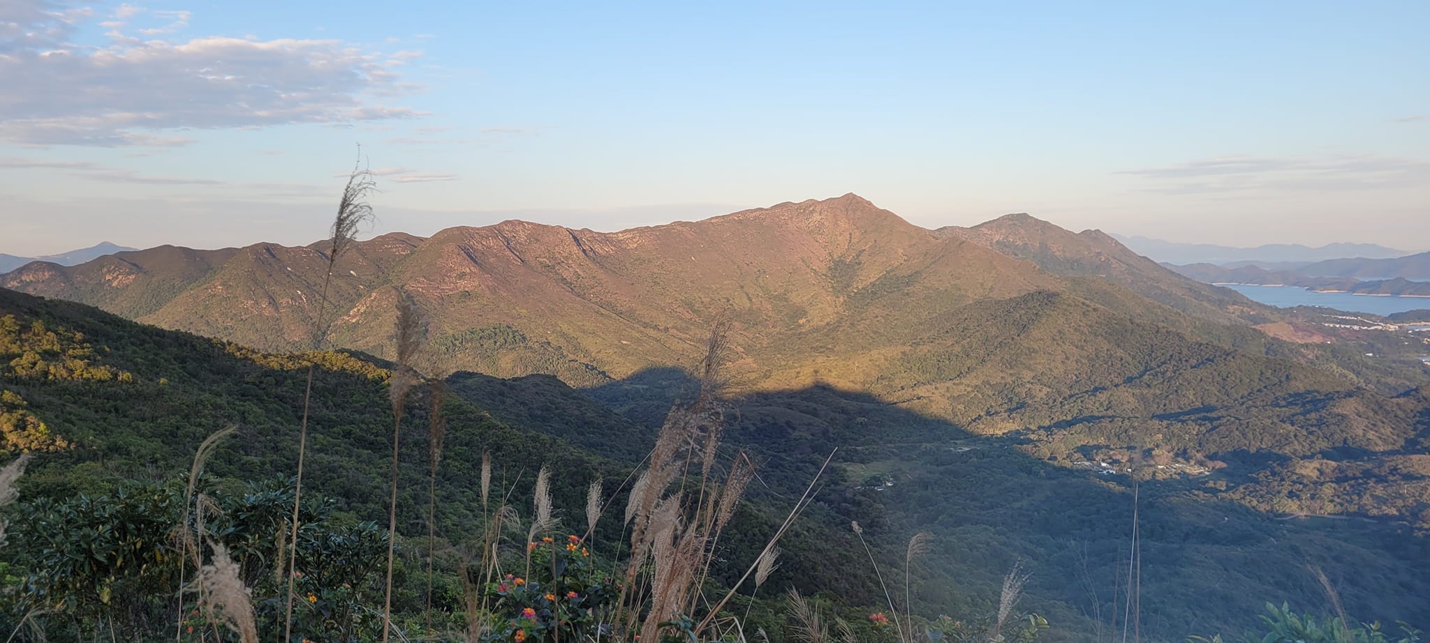
Image: Wikimedia Commons / CC BY-SA 4.0.
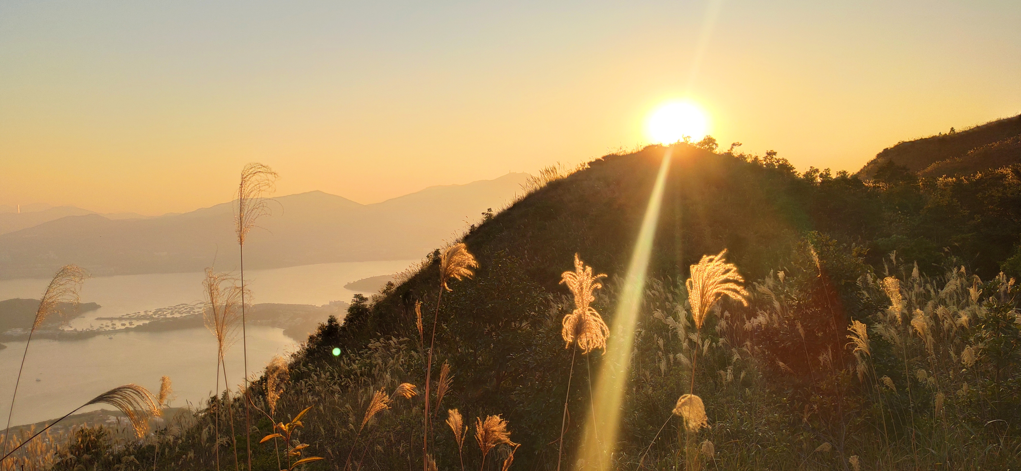
Image: Wikimedia Commons / CC BY-SA 4.0.
Here’s how to walk it. MTR Tai Po Market Station Exit A2 to the Tai Po Market bus terminus across the road, take bus 75K (the same one that goes to the Plover Cove dam) to Tai Mei Tuk, about 30 minutes. Get off and walk inland along Tai Mei Tuk Road for about 10 minutes to Spring Wind Pavilion, then up about 1 hour and a half to Benevolent Pavilion, then 1 more hour to Immortal Maiden Peak. To do the full Eight Immortals, continue east along the ridge from Immortal Maiden to Chunyang Peak, descending to Bride’s Pool or Wu Kau Tang — total 6 to 7 hours. Winter is best — December to February brings low temperatures and good visibility; April to May is dry and is the peak hill-fire season — during red hill-fire warnings police may temporarily close some entrances.
You don’t need to bring flowers, and you don’t need to photograph the memorial. Remember the seven names — that’s enough. Above Benevolent Pavilion the ridge opens up quickly: south is the silver of Tolo Harbour, north the blue of Plover Cove Reservoir, wind blowing in from both sides. Pat Sin Leng is a ridge that walks long and clear, but every inch under your feet is held by the ash of that one year.
Part IV · Practical Compendium — Seasons, Gear, Supplies, Emergencies
After three Parts, a practical checklist for the four questions: “when to go, how to get there, what to bring, what to do when things go wrong.” All of this is common knowledge among Hong Kong’s hiking community, but rarely laid out for first-timers.
Season — November to March is best
November to March is the absolute window. Each other month has its own hassles:
- April to October is warm and humid; daytime apparent temperature often above 30°C, RH around 85%, with windless spots on the trail hitting 38°C. This is also the high-activity season for snakes and insects — be especially careful of the bamboo pit viper and the banded krait
- November is clear-sky season, the sky most transparent; December is the steadiest and the prime month for photography; January–February brings occasional cold waves — the city can drop to 5°C, Tai Mo Shan summit to 0°C or below with frost — which are actually the most beautiful days on Tai Mo Shan
- April–May is the last stable window before the thunderstorm season, but already inside the hill-fire warning cycle
- June–September is typhoon-heavy; whenever the Hong Kong Observatory issues a Black Rainstorm Warning or T8 typhoon signal, all government-managed trails close immediately and entrances are taped off
Transit — Octopus everywhere
Nearly every Hong Kong trailhead has direct public transit; the trick is knowing which line:
- Hong Kong Island: Dragon’s Back (bus 9 or 9X toward Shek O, from Chai Wan Station); other sections of the Hong Kong Trail (multiple entrances along the MTR between HKU and Wan Chai stations)
- Kowloon: Lion Rock (MTR Lok Fu Station Exit B, up via Chuk Yuen); Devil’s Peak (MTR Yau Tong Station Exit A2, 10 minutes on foot); Kowloon Peak (MTR Choi Hung Station, then bus 91 to the Fei Ngo Shan Road entrance, or from Diamond Hill by minibus to Pak Fa Lam)
- New Territories: MacLehose, Wilson, Pat Sin Leng, Tai Mo Shan — main connections from Tai Po Market Station or Diamond Hill Station by minibus/bus. Key numbers: 96R (Diamond Hill MTR ↔ Sai Kung, public holidays only; the standard connector for MacLehose Stages 1–2), 75K (Tai Po Market Station ↔ Tai Mei Tuk), 51 (Tsuen Wan ↔ Kam Tin, crossing Tai Mo Shan via Tai Mo Shan Road; you can ring the bell to get off at the country park entrance midway)
- Outer islands: Lantau Trail first requires MTR to Tung Chung Station, then bus 23 to Ngong Ping — the standard way up Lantau Peak or into western Lantau
The Octopus card works throughout — top up at MTR stations, convenience stores, or the airport. Note that rural minibuses often have no Cantonese station announcements and no English signs; open Google Maps en route and ring the bell 200 m before your stop.
Gear list — Don’t overprepare
Hong Kong’s mountains are low, close, and well-supplied. The simpler your gear, the more reasonable.
- Shoes: low-cut trail-running shoes (summer) or mid-cut waterproof (winter and misty mountains like Tai Mo Shan summit). Regular runners are fine for Dragon’s Back and Lion Rock, but you’ll slip on the gravel pitch of Sharp Peak on MacLehose Stage 2
- Water: 1.5 to 2 liters per person per 4 hours, doubled in summer. Most mountains have no resupply (Lantau’s Ngong Ping and Pat Sin Leng’s Tai Mei Tuk are exceptions)
- Sun protection: sun hat, sunscreen, sunglasses — UV is strong on Hong Kong’s mountains, especially September to November on clear days
- Emergency: a whistle (the most effective signaling tool when lost), a headlamp (any trip still on the mountain after 3 PM should have one), a rain jacket (Black Rainstorm comes without warning; don’t gamble), offline maps — recommend the Hong Kong Observatory’s “Enjoy Hiking” app (free, GPS, covers all official trails)
- Don’t bring: trekking poles are unnecessary for all short routes on Hong Kong Island and Kowloon; only Sharp Peak, the Pat Sin Leng traverse, and the steep Ma On Shan section of MacLehose Stage 4 actually use them
Emergency — 999, distance posts, Enjoy Hiking
Hong Kong is not 911 — the emergency number in Hong Kong is 999.
- 999 answers and asks police / fire / ambulance — for mountain incidents, ask for fire (Fire Services handles both hill fires and mountain rescue)
- If lost on the mountain, the first move is not to wander further; stay put and, when calling 999, report the nearest distance post number — Hong Kong’s main trails have a marker every 500 m, yellow or white in color, marked with a letter + number, e.g. “M124” means MacLehose Trail post 124, i.e. 500 m × 124 = 62 km in; similarly “W” for Wilson, “H” for Hong Kong Trail, “L” for Lantau Trail. Reporting the post number is faster than GPS — the rescue team’s maps are drawn on this grid
- The “Enjoy Hiking” app has built-in GPS and a “send my coordinates” function that can text your current location to an emergency contact or to 999
- The government’s Hiking Guide is free online: search “LCSD hiking” or visit
hkwalkers.net(a community-maintained trail database, unofficial but more detailed); the Observatory’shko.gov.hkcarries hill-fire warnings, lightning warnings, and rainstorm warnings
One last reminder: cellular signal is OK along most lines on Hong Kong Island and Kowloon, but there are long stretches of weak signal along MacLehose Stage 2 at Chek Keng, on the north slope of Tai Mo Shan, and in the middle of Pat Sin Leng. Before setting out, send your itinerary to someone not on the mountain and tell them: “If you can’t reach me by 7 PM tonight, please call 999.” That single line has saved a number of people over the past dozen years.
The Lion Rock that Roman Tam sang, the ribbon MacLehose cut in 1979, the gun positions set on Devil’s Peak in December 1941, the Spring Wind Pavilion erected at Tai Mei Tuk in February 1996 — this city has never been only Victoria Harbour and Central. Every mountain has been written on. Saturday morning at nine, sling on the backpack; from the MTR exit to the foot of the mountain is no more than fifteen minutes.